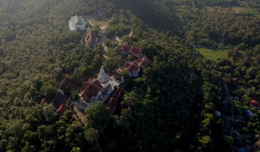
Sunday, August 28, 2016

Wat Phra Yai (Big Buddha Temple), Ko samui Thailand


Name : Wat Phra Yai (Big Buddha Temple)

Location :

The temple can be reached via a causeway from the main island of Koh Samui. From the airport, head north on route 4171. Take the second right and the first left, then follow until the road ends.

Description :

A dazzling temple featuring a towering 12-meter golden Buddha. Though by no means an ancient temple (it was built as recently as 1972), Thailand's Wat Phra Yai or "Big Buddha Temple" is still a cultural and artistic gem that's well worth a visit.


The temple complex is majestic, dazzling, serene, and perhaps a bit amusing all at once. Here, every available surface is drenched in gold and bedecked with ornate mirrored tiles the color of precious jewels. A wide skirt of steps flanked by two sinuous emerald dragons leads straight to the towering central figure: a 12-meter-tall golden Buddha. It sits atop a hill overlooking the stunning aquamarine waters surrounding the tiny islet of Koh Faan.

Sitting in Mara pose, this Buddha represents a state of enlightenment, purity and calm. Reflecting these principles, a ring of large bronze prayer bells encircles the Buddha, gently swaying in the cool ocean breeze. Use one of the provided wooden strikers to lightly ring each bell for good luck as you take in the glorious views.

In the early mornings, one can observe monks chanting their morning prayers as well as locals who bring offerings of food, incense and flowers. Be sure to pop into a few of the stalls surrounding the base of the temple during your visit. Local street food, fruit, flowers and fun souvenirs can be found aplenty. Neaby Chaweng Beach, Wat Plai Lem and Ang Thong National Marine Park are popular stops to check out during your visit as well.

Know Before You Go :

It is requested that visitors respect the sanctity of the space by wearing modest clothing (trousers or long shorts and tops that cover the shoulders), removing shoes before entering the complex and being courteous of local devotees.

Websites :


http://www.atlasobscura.com/places/wat-phra-yai-big-buddha-temple

Wednesday, August 17, 2016

Mount Popa Shrine

Name :  Mount Popa Taung Kalat Monastry. The name Popa is believed to come from the Pali/Sanskrit word puppa meaning flower

Location :

Mount Popa is a volcano 1518 metres (4981 feet) above sea level, and located in central Burma (Myanmar) about 50 km (31 mi) southeast of Bagan (Pagan) in the Pegu Range. It can be seen from the Ayeyarwady (Irrawaddy) River as far away as 60 km (37 mi) in clear weather. Mount Popa is perhaps best known as a pilgrimage site, with numerous Nat temples and relic sites atop the mountain.

Description :

Southwest of Mount Popa is Taung Kalat (pedestal hill), sheer-sided volcanic plug, which rises 657 metres (2,156 ft) above the sea level. A Buddhist monastery is located at the summit of Taung Kalat. At one time, the Buddhist hermit U Khandi maintained the stairway of 777 steps to the summit of Taung Kalat. The Taung Kalat pedestal hill is sometimes itself called Mount Popa and given that Mount Popa is the name of the actual volcano that caused the creation of the volcanic plug, to avoid confusion, the volcano (with its crater blown open on one side) is generally called Taung Ma-gyi (mother hill). The volcanic crater itself is a mile in diameter.

From the top of Taung Kalat one can enjoy a panoramic view. One can see the ancient city of Bagan; behind it to the north, the massive solitary conical peak of Taung Ma-gyi rises like Mount Fuji in Japan. There is a big caldera, 610 metres (2,000 ft) wide and 914 metres (3,000 ft) in depth so that from different directions the mountain takes different forms with more than one peak. The surrounding areas are arid, but the Mt Popa area has over 200 springs and streams. It is therefore likened to an oasis in the desert-like dry central zone of Burma. This means the surrounding landscape is characterized by prickly bushes and stunted trees as opposed to the lush forests and rivers Burma is famous for. Plenty of trees, flowering plants and herbs grow due to the fertile soil from the volcanic ash. Prominent among the fauna are macaque monkeys that have become a tourist attraction on Taung Kalat.

It is now a designated nature reserve and national park. Nearby lies Kyetmauk Taung Reservoir that provides sufficient water for gardens and orchards producing jackfruit, banana, mango and papaya as well as flowering trees such as saga (Champac) and gant gaw (Mesua ferrea Linn). A pozzolan mill to supply material for the construction of Yeywa Dam on Myitnge River near Mandalay is in operation.

Legends :

NAT Legends : 

Who are NATs ? : In Buddhist traditions of Myanmar, Nats are spirits of humans that met tragic ends and are portrayed accordingly in shrines across the country. One of the most well-known of the 37 spirits in the shrine of Mount Popa is Ko Gyi Kyaw, who died from his wild lifestyle and alcohol abuse. As the patron saint of tramps and alcoholics, his shrine is often covered in bottles of whiskey.

Many legends are associated with this mountain including its dubious creation from a great earthquake and the mountain erupted out of the ground in 442 BC. It is possible that the legends about Nats represent a heritage of earlier animist religions in Burmese countryside, which were syncreticised with Buddhist religion in the 11th century. There are legends that before the reign of Bagan king Anawrahta (1044 - 1077) hundreds of animals were sacrificed here as a part of nat worship rituals.

Mount Popa is considered the abode of Burma's most powerful Nats and as such is the most important nat worship center. It has therefore been called Burma's Mount Olympus due to the Nat activity and the shrine .

1) One legend tells about brother and sister Mahagiri (Great Mountain) nats, from the kingdom of Tagaung at the upper reaches of the Irrawaddy, who sought refuge from King Thinligyaung of Bagan (344-387). Their wish was granted and they were enshrined on Mt Popa.

2) Another legend tells about Popa Medaw (Royal Mother of Popa), who according to legend was a flower-eating ogress called Me Wunna, she lived at Popa. She fell in love with Byatta, whose royal duty was to gather flowers from Popa for King Anawrahta of Bagan (1044–1077). Byatta was executed for disobeying the king who disapproved of the liaison, and their sons were later taken away to the palace. Me Wunna died of a broken heart and, like Byatta, became a nat. Their sons also became heroes in the king's service but were later executed for neglecting their duty during the construction of a pagoda at Taungbyone near Mandalay. They too became powerful nats but they remained in Taungbyone where a major festival is held annually in the month of Wagaung (August).

Although all 37 Nats of the official pantheon are represented at the shrine on Mt Popa, in fact only four of them - the Mahagiri nats, Byatta and Me Wunna - have their abode here. Burmese superstition says that on Mt Popa, one should not wear red or black or green or bring meat, especially pork, as it could offend the resident nats, although Byatta and his brother Byatwi were the only Muslims who had shipwrecked and landed in Burma.

Burmese Myth :

There are many Burmese myths about the mountain, especially the one that said victory for any man who collected their army on the slopes of the mountain was guaranteed. The belief that victory can be guaranteed by visiting Mount Popa is interesting because it shows the cultural identification of life and prosperity with the mountain. The still current popularity of Mount Popa exemplifies the fact that Burmese people still rely heavily on ancient traditions in daily life. It is these ancient traditions that characterize the culture of the surrounding area and beyond. People travel great distances to assure their good luck into the coming years to Mount Popa, host to an immense annual festival which actually takes place in the temple atop the mountain.

Festivals :

Many Burmese pilgrims visit Mt Popa every year, especially at festival season on the full moon of Nayon (May/June) and the full moon of Nadaw (November/December). Local people from the foot of Mt Popa, at Kyaukpadaung (10-miles), go mass-hiking to the peak during December and also in April when the Myanmar new year called Thingyan festival is celebrated. Before King Anawrahta's time, hundreds of animals were sacrificed to the nats during festivals.

The festival involves a transgender medium being possessed by a nat spirit which give him the ability to communicate between the nats and the people. It is these types of festivals, the type that are unique to the region but also incredibly important to the participants, that attracts tourists to Burma.

Websites :

https://en.wikipedia.org/wiki/Mount_Popa

Sunday, August 7, 2016

Kondarangi Hills - Malligarjuna Swamy Temple


Name : Kondarangi Hills - Malligarjuna Swamy Temple

Location :

It is situated in Tamilnadu on the way to Tharapuram from Oddanchatram (via) Moolanur. It is 15kms from moolanur and the village is called Kondarangi Keeranur.

Legend :

1. It is believed that when we do meditation on Pournami or Amavasya days on the top of this hill, we can get connection with our ancestors and their blessings.

2. It is said that there is a shusma vibrations between palani Temple and this temple. Kondrangi Shiva is seeing his Son from here. Also we can see this hill when we climb Palani hills.

3. Pandavas of mahabharata are said to have done meditation in the cave here. It is said that Arjuna attained powers during his vana vasa here. They say when we meditate in this hill we can travel to a diffreent Astral World.


Description :

This Hill has a steep Conical shape and it is about 748meters high. There is a very wonderful Rock cut Temple on the top where Lord Shiva showers his blessings in the name of Malligarjuneswarar. It is a Swayambhu Lingam ( Formed on its owns ). The hill itself looks like a Huge Linga.

The steps are rock cut and it seems very difficult to climb the hill. But with Lord shiva's blessings it is very easy to reach the top. It takes two hours to reach the top. If there is Rain or high winds it will be difficult to ascend or descend. There is a perennial spring on the top.


There is a Cave where Sidhhars and Thavasis have done meditation. There is also a Temple located at the foothills known as Ketti Malleswarar Sri Bhramaramba Temple.

Festivals :

Chitra Pournami and maha Shiva Ratri is celebrated in grand manner when lot of devotees throng to get blessings of Malligarjuna swamy


Websites :

I sincerely thank Mr.Dhanasekar who maintains a facebook page on Kondarangi malai for providing all the above details. Link to his page is as below. Devotees who wish to visit kondarangi malai can contact him for further details.

https://www.facebook.com/KondarangiHills/

http://www.youtube.com/watch?v=f1yXRdLB88w

Sunday, July 10, 2016

Ratnagiri Murugan Temple, Saravanampatti

Name : Ratnagiri Murugan Temple

Location :

Sri Ratnagiri Murugan Temple, Saravanampatti, Coimbatore district.
+91 - 422- 553 5727

Legend :

Many years back, a woman devotee was praying to Lord Ratnagiri Muruga for long years seeking child boon.  She was undergoing severe fasting for the boon.  One day, she came to the temple alone when no one was present in the surroundings.  She was in deep meditation for a long time shedding tears and was going round the temple.  A cow boy enquired her of her sorrow.  The woman told him of her want.  The boy gave her a little sacred ash and advised her to go round the prakara with her prayer.  After finishing the first round, when the woman wanted to see the boy, he was not there.

The woman conceived within a few days then and understood that the boy was no less a person than Lord Muruga Himself.  The temple has the reputation of blessing a woman devotee in person  gifting her wish.

Lord Sri Muruga graces with four hands on His peacock facing the left side.  Lord Vinayaka – Swayambu Vinayaka from a rock – is by the side.

Poo parithal – picking flowers:

It was customary in days of yore, that boys and girls related to each other qualifying a marriage liberty (Murai Mappillai and Murai Penn) visit the temple together on Mattu Pongal day (almost on January 15 according to the Gregorian calendar).  The bridegroom-boy will offer the flowers to his fiancée.  They will then offer garlands to the Lord with the prayer to unite them in wedlock.  The custom has vanished in the modern days.  Yet, lovers aware of the custom visit here to pray to Lord Muruga to succeed in their love affair.

The belief still remains that any one bringing flowers, making a garland himself/herself and offer it to the Lord will have the life partner of his/her choice.  After marriage, they come again to offer their grateful prayer to the Lord to have wise children.

Also, school friends, though placed in different places due to their occupations, use to come to this place, pray to Lord Muruga and share their old experiences.  The tradition is still followed, on the Mattu Pongal day.

Description :

Temple Speciality is Lord Swayambu Vinayaka appearing from a rock graces in the temple.
A demon performed penance for centuries on Lord Shiva and got the boon to rule all the worlds. Intoxicated by the power of the boon and his prowess, he began to harass the devas very cruelly forcing them to live in oblivion.  Once the demon saw Indira, the king of devas in his hideout.  Indira began to run but the demon chased him.  Indira reached this Ratnagiri mount where Lord Muruga changed him as a peacock, his vehicle.  The demon returned disappointed.  The wonder took place here, according to scriptures.

Festivals :

Thaipoosam in January-February, Mattu Pongal falling almost on January 15, New moon days, Kruthika days, Vaikasi visakam in May-June are the festive days observed in the temple with special pujas. The temple is open from 6.00 a.m. to 2.00 p.m. and 4.00 p.m. to 7.30 p.m.

Websites :

http://temple.dinamalar.com/en/new_en.php?id=772

Jnana Malai Murugan Temple, Kaverippakkam

Name : Jnana Malai Murugan Temple

Location :

Until recently the celebrated Jñāna Malai (Mount of Wisdom) could not be identified. Lord Jñāna Murugan only recently disclosed His presence at Jñānamalai situated near Kaverippakkam in Vellore district at a small village called Govindacheri 14 kilometres from Kaverippakkam. Though it a small hillock, yet there is no easy way to reach the top of the hill.

Description :

Lord Muruga is the embodiment of jñāna (spiritual insight). He is Jñāna Panditan, Jñānaswaroopan, etc. By worshipping the Lord as Jñāna Panditan, one obtains jñāna.

There is a small Murugan temple on this hill. In 1998 some local people along with Archeological Department officials discovered a worn stone inscription which translated affirms:

"...in the 18th year of King Sambuvarayar's rule, his son Prince Kaligarayan established steps to reach Jnānamalai of this village..."
The period is established as AD 1322-1340. On seeing this news item in the newspaper Dinamani our tiruppugazh thondar Ra. Krishnan, the author of several books including Arunagirinathar Adicchuvattil (In the Footsteps of Arunagirinathar), visited the site, conducted research and established conclusively that this sthalam is indeed Jñāna Malai celebrated in the songs of Saint Arunagirinathar.

Hectic activity followed, and last year some abishekams were performed by our Siruvapuri Murugan Abishega Committee and on 15 September 2000 kumbhabhishekam was performed after moderate renovation by the villagers.

There is a small temple in typical Pallava style on the hill with a small sanctum and a mandapam. The Lord is in the form Brahmasastā having rosary and kamandala in two hands. The other two hands are in abhaya mudra and resting upon the hip. Generally in Thondai Mandalam (north Tamil Nadu) Pallava and early Chola images conform to this Brahmasastā form. About three feet high with Valli and Devasena as consorts, these are beautiful moolasthana vigrahas. He is called Bālasubramanyar by local people.

Near the temple there is a small natural water source from which water is brought for temple abulations. On to the west there is a small Siva temple and behind we can see footsteps in the rock. They appear as footprints on molten lava. Incidentally this is a volcanic mountain from all appearances.

Foot steps of Lord Muruga
These footsteps are considered by the local folks as those of Lord Muruga Himself. There is also a belief that Murugan visited this place after marrying Valli Amman in Vallimalai on way to Tiruttani. Tiruttani and Vallimalai form form a triangle with Jñāna Malai and both can be seen from this hill. Around the hill there is a lake and in rainy season will look like an island.

Arunagirinathar came to Jnanamalai and recalled "his experience of being hated by his wife, own family members and local folks, decides to end his life and at that time Murugan shows His lotus feet and bless him. He wants the same blessing again." This internal evidence of the saint's life is found only in the Tiruppugazh of Jñāna Malai.

This tiruppugazh starts with "Maniaval nagaikka ooril anaivarum nagaikka loka..." There is also another Tiruppugazh for Jnanamalai starting "Soodukolai..."

Help make Jñāna Malai accessible to Murugan devotees

In order to facilitate worship this important Murugan temple we need to provide steps and other basic amenities.

Siruvapuri Murugan Abishega Committee members have decided to construct the steps as well as other facilities. As a first step on 19 August 2001 in the presence of Mr. T.R. Srinivasan (I.A.S.), Special Commissioner for Hindu Religious Charitable Endowments of the Government of Tamil Nadu, a foundation stone was laid and the formal inauguration of this great task was undertaken with the blessings of Lord Jnanamalai Murugan. For about five hours Thiruppugazh Anbargal sang tiruppukazh followed by abhishekam and annadanam. Hundreds of people attended this great event.

Murugan adiyars who wish to contrbute to this great cause are strongly encouraged to make material contributions. The hill needs about 225-250 stone steps to reach the summit. Each stone step costs about Rs. 2,000 (or US$ 42) to construct. In addition we intend to construct a small mandapam for the devotees in front of the sannidi and also other basic facilities (cooked food for annadanam is brought from Chennai currently). There will also be two small stone mandapams for pilgrims to rest on the way up and one at the foot of the hill as well.

Murugan adiyars and Kodaivallals are welcome to contribute liberally to the noble cause of steps. With each step, you will be drawn one step closer to Jñāna Malai Jñāna Panditan.

Websites:

Ratnagiri Murugan Temple


Name : Rathinagiri Bala Murugan Temple

Location :

The Ratnagiri Balamurugan Temple is situated at Vellore in TamilNadu.This temple is around 13 kms away from Vellore adjacent to the vellore chennai national highway. Ratnagiri Bala Murugan temple is a small and cute temple. Lot of devotees visit Vellore Golden Temple, or travel to Vellore can visit this great shrine of Lord Murugan and get his blessings.

Greatness of the Shrine:

Rathinagiri Bala Murugan Temple was built around the 14th century. Over the passage of time an ordinary sand structure was converted into a stone shrine. Ancient Hindu scriptures say that wherever there is a hill, Lord Murugan resides as the all-powerful Deity. Of these Tirupparamkundram, Tiruchendur, Tiruvavinankudi, Tiruveragam and Palamuthircholai are famous shrines, collectively called 'Kundruthoradal'. The holy shrine at Rathinagiri also features in this category.

Literary Evidence:

The 14th Century poet Arunagirinathar has sung about this temple as Rathinakiri Vazh Murukane Ilaya Vaaramarar Perumaley', which means 'Murugan, the God of Devas resides in Rathinagiri'.

Divine Blessings

The Omnipotent Power manifests His Blessings to mankind in three forms:

In the form of idol in the shrine.
In the form of the guru.
In the form of the devotee.
Of these three, Lord Bālamurugan manifests himself at Rathinagiri in two forms. The first is in the form of the deity with his two consorts Valli and Teyvanai. The second is in the form of our Guru, Swami Bālamurugan Adimai.

The History of Swami Balamurugan Adimai through whom the Blessings of Lord Bālamurugan are channeled to us is praise worthy.

History of Swami Balamurugan Adimai

Born on the 24th of January 1941 (in the Vikrama year of the Tamil calendar on the 11th day of the month of Thai) in the small village of Kilminnal adjacent to Rathinagiri, he was the fourth child born to Śrī Kandaswami Mudaliar and Smt. Sinagarammal. He was named Dakshinamurthy and Sachidanandam, both being names of Lord Shiva.

On completion of his schooling he entered the services of the Electricity Department. Soon after, he entered into holy matrimony with Sivakami and was blessed with two daughters and a son.

One day in his 27th year, on his way to work, he climbed the hill to offer his prayers. There was neither camphor nor incense available at the temple. He walked around the shrine with a heavy heart and was suddenly overcome with divine awakening. He fell in a faint to the ground and on waking up was unable to remember his own self. He dressed himself in a loincloth. He took a sacred vow not to leave until the temple was restored to its former glory.

This memorable event of Swami's spiritual awakening took place on 20th March 1968. Ever since then Swami's spiritual well being of his devotees has continued unabated.

Cottages for visitors

Cottages for the devotees have been built and are available. Separate pathways were laid to ascend and descend the hill.

Temple hours

Temple is kept open between 6 am to 1 pm & 4 pm. to 8 pm.
Abhishekam timings: 6 am to 10:30 am & 5:30 pm.
Temple office working hours: 9 am to 1 pm & 3 pm to 6 pm.
Days of principal importance in the calendar year

Tamil New Year Day;
Ādi Krittikai celebrations (Lord Murugan's Birthday);
Ādi Velli (auspicious Friday in the month of August or September);
Kanda Shashti celebrations (Six Days);
Navaratri (Nine Nights of the Goddess Festival);
Panguni Uttiram;
January 1st;
The anniversary of Swamiji's enlightenment 20th March

Website :

http://murugan.org/temples/ratnagir.htm

Saturday, July 2, 2016

Yaganti Uma Maheswara Swamy Temple & Agastiya and Venkateswara swamy Cave Temples

Name : Yaganti Uma Maheswara Temple

Location :
Yaganti is located in the Kurnool District in the state of Andhra Pradesh, India, approximately 100 km from the city of Kurnool and 75 kms from Tadipatri in the state of Andhra Pradesh. The temple is 14 km west of Banaganapalle (Mandal headquarters) on the Banaganapalle-Peapully road. This place is nestled in the middle of some hostile terrain like the the dry, rocky region of Erramala Hills.

Legend :
One story of the site's origin is as follows: The sage Agastya wanted to build a temple for Lord Venkateswara on this site. However, the statue that was made could not be installed as the toe nail of the idol got broken. The sage was upset over this and performed a penance for Lord Shiva. When Lord Shiva appeared, he said the place suits Shiva better as it resembles Kailash. Agastya then requested Lord Shiva to give the devotees a Parvathi Goddess as Lord Uma Maheswara in a single stone, which Lord Shiva obliged.

A second story is as follows: Chitteppa, a devotee of Lord Shiva, was worshiping Lord Shiva and Lord Shiva appeared to him as a tiger. Chitteppa understood that it was Lord Shiva in tiger form, and shouted Neganti Shivanu ne kanti (meaning: I saw Shiva I saw), and danced with joy. There is a cave called Chitteppa nearby.

Popular Beliefs :

Growing Nandi :
The devotees believe that the Nandi idol in front of the temple is continuously increasing its size. The locals say that the idol was initially much smaller than its present size. They say that certain experimentation was carried out on this idol and it was said that the type of rock out of which the idol is carved has a growing or enlarging nature associated with it. Archaeological Survey of India has confirmed that the idol increases by 1 inch in every 20 years. Experiment suggests that the rock used to make the idol exhibits a growing nature.

It is said that people used to do Pradakshinas (rounds) around it in the past. The temple staff has already removed one pillar as the size of the Nandi has increased.

According to Potuluri Veera Brahmendra swamy, the Basavanna (stone nandi) of Yaganti will come alive and shout when Kali Yuga ends.
Absence of crows

Legend has it that while the Sage Agastya was performing his penance, crows disturbed him and he cursed that the crows cannot enter the place. As the crow is the Vahana for Lord Shani, it is believed that Lord Shani cannot enter this place.

Description :

This temple was constructed by King Harihara Bukka Raya of the Sangama Dynasty of the Vijayanagara Empire in the 15th century. It was built according to Vaishnavaite traditions.

Sri Yaganti Uma Maheswara Temple is one of the few temples patronized by one of the great dynasties of India. Every year Maha Shivaratri is celebrated and a large number of devotees from all over Andhra Pradesh visit. Shiva, Parvati and Nandi are the main deities in this temple.This temple is 14 km away from Banaganipalli in kurnool dt. The saint lord Veerabrahmendra swami stayed here for some time and wrote Kalagnanam.

A feature of this temple is its Pushkarini, a small pond of water on the temple premises. Water flows into this Pushkarini from the bottom of hill through the mouth of a Nandi (bull). The water is fresh and sweet, as it comes from the hills. No one knows how the water reaches the pond all year round and this temple architecture in terms of its sculpture shows the skills of ancient Vishwakarma Sthapathis. Devotees find that a holy bath in Pushkarini is highly beneficial. After taking a bath in Pushkarini, they pay tributes to Lord Shiva.

The sage Agasthya bathed in Pushkarini and worshipped Lord Shiva.

Yaganti Caves :
Agastya Cave :
This is the cave where Agastya performed his penance for Lord Shiva. One can enter the cave by climbing 120 steep steps. An idol to Devi is installed and may be worshipped here.

Venkateswara Cave :
The damaged idol of Lord Venkateswara is present in this cave. Compared to Agastya cave it is easy to climb though the steps are steep. According to the story this idol was present in this cave before the Tirumala Venkateswara Temple was constructed. But as the idol is damaged near the foot, it could not be worshipped. Sri Sri Potuluri Veera Brahmendra Swami tells us in his Kala Gynanam that this place can stand as an alternative to Tirupati. This temple has very beautiful scenic locations nearby.

Veera Brahmam Cave :
This is the cave where saint Sree Potuluri Veera Brahmendra swamy wrote some of his Kala Gnaanam (prophecy). The height of the cave is less and one needs to bend half over to enter it.

Websites :

https://en.wikipedia.org/wiki/Yaganti

Friday, June 17, 2016

Panch Kedar Yatra (pilgrimage)

Panch Kedar (Sanskrit: पंचकेदार) refers to five Hindu temples or holy places of the Shaivite sect dedicated to god Shiva. They are located in the Garhwal Himalayan region in Uttarakhand, India. They are the subject of many legends that directly link their creation to Pandavas, the heroes of the Hindu epic Mahabharata.

The five temples designated in the strict pecking order to be followed for pilgrimage for worship are the Kedarnath (Sanskrit: केदारनाथ) at an altitude of 3,583 m (11,755 ft), the Tungnath (तुंगनाथ)(3,680 m or 12,070 ft), Rudranath (रुद्रनाथ) (2,286 m or 7,500 ft), Madhyamaheshwar (मध्यमहेश्वर) or Madmaheshwar (3,490 m or 11,450 ft) and Kalpeshwar (कल्पेश्वर) (2,200 m or 7,200 ft). The Kedarnath is the main temple, which is part of the four famous Chota Char Dhams (literally 'the small four abodes/seats') or pilgrimage centers of the Garhwal Himalayas; the other three dhams are the Badrinath, Yamunotri and Gangotri. Kedarnath is also one of the twelve Jyotirlingas


History

It is said that the Panch Kedar Yatra (pilgrimage) could be directly related to the Gorakhnath cult (recognized for their pilgrim traditions) of Nepal. As a proof, it is stated that the culmination of the pilgrimage was at Pashupatinath temple in Nepal, rightly where Lord Shiva’s head is worshipped and not at Kedarnath where the hump is venerated. A further supporting fact mentioned in this regard is that the emblem used in Kedarnath temple dome is the same as displayed in the Pashupathinath temple dome in Kathmandu.

Legends

Many folk legends related to the Garhwal region, god Shiva and the creation of the Panch Kedar temples are narrated.

The most famous folk legend about Panch Kedar relates to the Pandavas, the heroes of the Hindu epic Mahabharata. The Pandavas defeated and killed their cousins — the Kauravas in the epic Kurukshetra war. They wished to atone for the sins of committing fratricide (gotra hatya) and Brāhmanahatya (killing of Brahmins — the priest class) during the war. Thus, they handed over the reigns of their kingdom to their kin and left in search of the god Shiva and to seek his blessings. First, they went to the holy city of Varanasi (Kashi), believed to Shiva's favourite city and famous for its Shiva temple. But, Shiva wanted to avoid them as he was deeply incensed by the death and dishonesty at the Kurukshetra war and was, therefore, insensitive to Pandavas' prayers. Therefore, he assumed the form of a bull (Nandi) and hid in the Garhwal region.

Not finding Shiva in Varanasi, the Pandavas went to Garhwal Himalayas. Bhima, the second of the five Pandava brothers, then standing astride two mountains started to look for Shiva. He saw a bull grazing near Guptakashi (“hidden Kashi” — the name derived from the hiding act of Shiva). Bhima immediately recognized the bull to be Shiva. Bhima caught hold of the bull by its tail and hind legs. But the bull-formed Shiva disappeared into the ground to later reappear in parts, with the hump raising in Kedarnath, the arms appearing in Tunganath, the nabhi (navel) and stomach surfacing in Madhyamaheshwar, the face showing up at Rudranath and the hair and the head appearing in Kalpeshwar. The Pandavas pleased with this reappearance in five different forms, built temples at the five places for venerating and worshipping Shiva. The Pandavas were thus freed from their sins. It is also believed that the fore portions of Shiva appeared at Pashupatinath, Kathmandu — the capital of Nepal.

A variant of the tale credits Bhima of not only catching the bull, but also stopping it from disappearing. Consequently, the bull was torn asunder into five parts and appeared at five locations in the Kedar Khand of Garhwal region of the Himalayas. After building the Panch Kedar temples, the Pandavas mediated at Kedarnath for salvation, performed yagna (fire sacrifice) and then through the heavenly path called the Mahapanth (also called Swargarohini), attained heaven or salvation.[citation needed]

After completing the pilgrimage of Lord Shiva's darshan at the Panch Kedar temples, it is an unwritten religious rite to visit Lord Vishnu at the Badrinath Temple, as a final affirmatory proof by the devotee that he has sought blessings of Lord Shiva

Worship rights

The priests and pundits who worship in the Panch Kedar temples are from South India, except in Tungnath. Namboodiri brahmins hailing from Malabar, in Kerala officiate as chief priests at Badrinath temple and they are known by the name Rawals. Jangamas who are pure Lingayatisms from Chitrakal in Mysore are the chief priests at the Madhyamaheswar temple. Dasnami Gosains founded by Adi Shankaracharya are the chief priests in Rudranath and Kalpeshwar temples. The Tunganath temple is served by the Khasi Brahmins. In the case of Tungnath, it is also said that the local brahmins from Mokumath officiate as priests.

Kedarnath Teerth Purohit all Kedarnath Teerth Purohit (Panda) are the ancient brahmin of this himalaya region of Kedarkhand, these are there from the end of treta yug and start of kaliyug, when pandava came to himalaya for finding moksh, and then went to mahapanth, after their journey to mahapanth, their grandson King Janmejay came to Kedarnth and gave the right of worshiping of Kedarnath temple to these brahmins

THE TREK :

The total trek length to cover all the five temples of Panch Kedar is about 170 km (including road travel up to Gaurikund), involving 16 days of strenuous and rewarding effort. The trek starts from Gauri Kund, one of the picturesque spots, providing spectacular views of the Himalayan range of hills in the entire Garhwal region, comparable to the Alps. The trekking is undertaken during two seasons; three months during summer and two months after the monsoon season, as during the rest of the period, except Rudranath, the other four Panch Kedar temples are inaccessible due to snow cover.

The road from Rishikesh is the first entry point to Garhwal from the plains of Uttarakhand. Rishikesh is approachable from Delhi by road over a distance of 230 km. The road from Rishikesh leads to the Gaurikhund on the Rudraprayag–Kedarnath road from where the trekking would start to Kedarnath temple. The trek to Kedarnath is of 14 km, each way. After Kedarnath, road travel to Guptakashi and further to Jagasu covers a distance of 30 km. From Jagasu, the trek to Madhaymaheshwar temple via Gaundhar is over a distance of24 km (15 mi). This trek provides spectacular views of the Chaukhamba, the Kedarnath and the Neelkanth peaks. Returning from Madhyamaheshwar the road drive to Chopta via Jagasu is of 45 km. From Chopta, the trek is to the Tunganath temple over a distance of about 4 km. After the Tunganath trek, the drive along the road up to Mandal (known Cherrapunji of Garhwal due to heavy rainfall) is for a distance of8 km. From Mandal, the trek to Rudranath temple is of 20 km. After visiting Rudranath temple the return journey is to Mandal and the drive down by road to Helang. From Helang, the trek to Kalpeshwar temple is for 11 km via Urgam village and is considered strenuous due to the steepness of the route. After completing the pilgrimage trek of Kalpeswar temple, the last of the Panch Kedar temples, the return road drive from Helong to Riishikesh via Pipalkothi is a distance of 233 km.

Worship during winter season

During the winter period when the temples are inaccessible due to snowfall, the sanctified symbolic Shiva idol of Kedarnath is worshipped at the Omkareshwar temple at Ukhimath, the representational idol of Tunganath is worshipped at Mokumath, the Rudranath symbolic image is brought to Gopeshwar, and the Madhyamaheshwar symbolic idol is venerated at Ukhimath

Websites :

https://en.wikipedia.org/wiki/Panch_Kedar

1. Kalpeshwar
2. Rudranath
3. Madhyamaheshwar
4. Tungnath
5. Kedarnath 
Friday, April 29, 2016

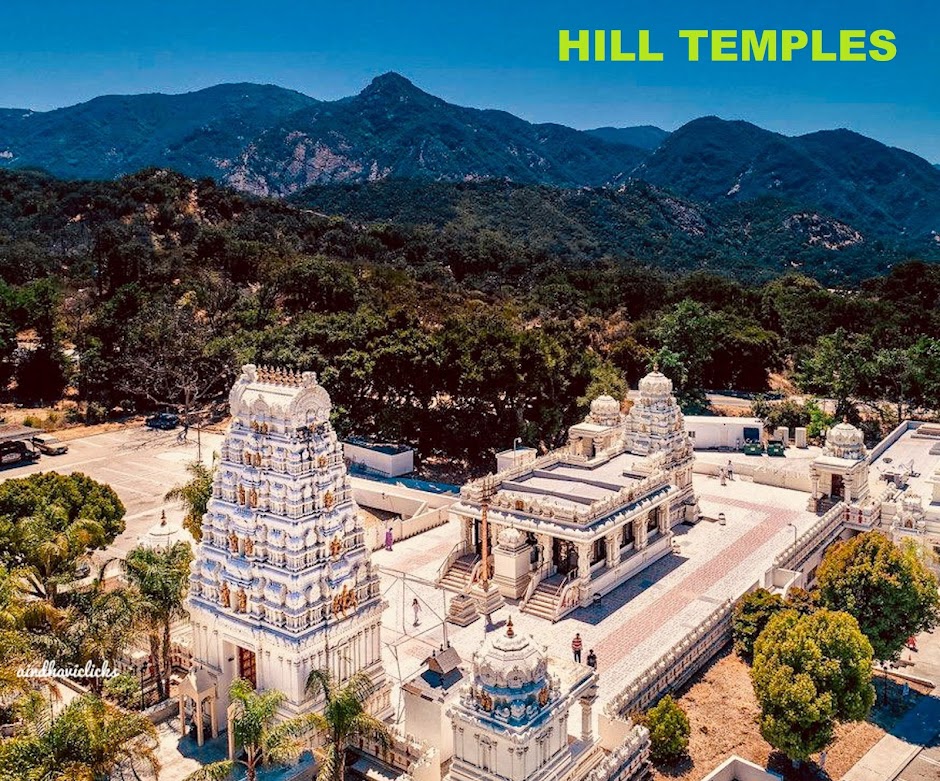
Tibidabo Spain


Name : Tibidabo - Mountain where Jesus was first tempted by the Devil

Location :

A mountain overlooking Barcelona, Catalonia, Spain, Tibidabo stands more than 500 meters tall. The highest peak anywhere in the Serra de Collserola range, Tibidabo is home to an amusement park, a telecommunications tower, and Sagrat Cor, a Catholic church.

Legend :

Sagrat Cor is perhaps the most fitting of Tibidabo's attractions as this is the site where local legend says the devil tempted Jesus. The name Tibidabo derives from the Latin Vulgate Bible verses, Matthew 4:9 and Luke 4:6. The phrase, tibi dabo, means I will give to you. It was supposedly said to Jesus by the devil as they looked down from a mountain on the kingdoms of the world. The name of Barcelona's hill, then, refers to how it is the tallest anywhere around.

Description:

Designed by Enric Sagnier, the church took about 60 years to build. At the top of the church, Sagrat Cor, is a sculpture of the Sacred Heart by Josep Miret Llopart.

Tibidabo can be reached by a funicular railway, by bus, and by car. The railway, built in 1901, was the first of its kind in Spain. The amusement park is also the oldest of its kind in the area. Constructed in 1899, the park offers more than thirty different rides, some of them dating back many decades. A few of the original attractions are also still operating, including the Museu d'Autòmates (Mechanical Museum).
 

Websites :
http://www.atlasobscura.com/places/tibidabo

El Peñón de Guatapé


Name : El Penon de Guatape

Location :

La Piedra Del Peñol (Spanish for "The Rock of Guatapé"), also known as El Peñol Stone or simply La Piedra (Spanish for "The Stone"), is a monolithic formation located at the town and municipality of Guatapé, 1 km inside the city limits (86 km northeast of Medellín or 2 hours by bus) in Antioquia, Colombia.

History :

The wide Antioquian rock base, called "batlolito antioqueño", and the "Peñón" were formed millions of years ago.

The Tahamies Indians, former inhabitants of this region, worshiped the rock and called it in their language "mojarrá" or "mujará" (rock or stone).

Description :

This rock is located in the rural area called "La Piedra", just 5 minutes from the town of Guatapé, and can be reached by road.

On the northern face of the stone there are painted large white letters, "G", and an incomplete "U" (only the single vertical stroke was completed). Guatapé and El Peñol had long disputed ownership of the rock, and the residents of Guatapé decided to settle the matter by painting the town's name on the rock in huge white letters. It did not take long for the residents of El Peñol to notice the work, and a large mob was assembled to stop it. Only the "G" and part of the "U" were completed.


The rock was first climbed officially on July 1954. In 2006, Luis Villegas, Pedro Nel Ramírez and Ramón Díaz climbed the rock in a five-day endeavor, using sticks that were fixed against the rock's wall. (It is unknown whether the Tahamies had a way of ascending the stone.). Climbing the huge stone took five days, but the top of the rock revealed beautiful views and a new species of plant, Pitcairma heterophila. The rock soon became a modest tourist attraction.

A new species of plant was found on the top of the rock, subsequently named Pitcairma heterophila by a German scientist.

A viewing spot was built on top of the rock, where it is possible to acquire handicrafts, postcards, and other local goods. It is possible to see the 500 km shore-perimeter dam. There are 740 steps to the uppermost step atop the building at the summit, a fact reinforced by yellow numbers also seen in the climb up the stairs.

In the 1940s, the Colombian government declared it a "National Monument"

Composition :

The Stone of Peñol is composed of quartz, feldspar and mica. The rock, which is almost entirely smooth, has one long crack, the one that the climbers used in ascending it. In the crack was later wedged a 649-step masonry staircase, that appears like a giant stitch holding the split rock together, the only way to get to the top of the Piedra de Penol. In the 1970s, the area was dammed, and the view from the rock changed: It now overlooks a dramatic series of lakes and islands.

Today, you can ascend the rock (apparently owned by a local family, though also designated by Colombia as a "national monument") for 2 US dollars. There you'll find a few religious relics and a three-story lookout tower.

Websites :

http://www.atlasobscura.com/places/el-penon-de-guatape

https://en.wikipedia.org/wiki/El_Peñón_de_Guatapé

Sunday, April 17, 2016

Wat Phrathat Doi Saket


Name : Wat Phrathat Doi Saket

Location
Wat Phrathat Doi Saket is located in the Doi Saket district, just outside the city of Chiang Mai. Travelling to the temple by motorbike or car will take approximately 30 minutes from the center of Chiang Mai. Doi Saket is located on the road north to Chiang Rai (Highway 118), just before the climb up the mountain on the right hand side. The Doi Saket district is predominantly a rural farming area, with plenty of rice fields in the valley as well as orchards and other farming on the mountainsides. Travelinasia have attached a map to this article showing how to get there from Chiang Mai.


History
The temple at Doi Saket is said to have been built in the year 1112. The legend is that the Lord Buddha had come to Doi Saket for a short time, and was visited by naka whom he offered his hair for the purpose of worship. Shortly after he is said to have dissapeared, and this is the reason for the location of the temple. Thai artist, "Khun Chaiwat Wannanon" began painting the interior of the temple walls with spiritual Buddhist murals in the early 1990s. It took over 4 years for the murals to be completed. This is something that is unique to the temple at Doi Saket. Normally modern art is not featured in Buddhist temples in Thailand, so this is somewhat unique to Doi Saket.

Modern Buddhist Paintings at Wat Phrathat Doi Saket : 
There are lot of beautiful modern paintings in this temple. Ryan Zander who resides in Chian mai describes the paintings in detail in his blog post http://siamandbeyond.com/modern-buddhist-paintings-wat-phrathat-doi-saket/

Description :

The temple at Doi Saket is similar to the Doi Suthep Temple, yet smaller in size. The temple’s chedi, or stupa, glistens in the sunlight with both gold and silver. It is actually composed of a building that you can enter with the dome mounted on top. Inside, you’ll find a passageway to circumambulate the sacred relics kept here.  The entrance to the temple (as is the case at Doi Suthep) has a steep set of stairs leading to the temple. The most prominent feature of the Doi Saket Temple is the giant golden sitting Buddha (Phra Buddha Pathimakorn), visible from the road leading to the temple. The interior walls of the temple are decorated with modern spiritual murals, painted by Khun Chaiwat Wannanon. There is also a monastic school located on the grounds of the temple. There is a Chinese-style pavilion containing a shrine to Guan-Yin, the Bodhisattva of Compassion. As the East Asian version of Avalokiteshvara, Guan-Yin is technically part of the Mahayana pantheon and doesn’t play any official role in traditional Theravada Buddhist practice. Yet, the influence of China upon Southeast Asia is so strong that you’ll find Guan-Yin at many Thai temples, where she’s worshiped just as much for good luck as she is for striving to accumulate virtue. The Chedi features the relics of Buddha and a Golden Umbrella.

Aerial Photos
AERIAL PHOTOS BY HELI-ASIA

Etiquette
When you visit any temple, or government office in Thailand, you are expected to dress appropriately. Proper dress includes wearing long pants or trousers, with a sleeved shirt as apposed to shorts and sleeveless shirts. Women should dress conservative, without displaying skin, short skirts and tank tops are frowned upon. You will also be asked to take off your shoes before entering the temple, you will see hundreds of peoples shoes in a pile at the entrance. Once inside the temple, you should make sure not to offend anyone, keep your voice down and try to not to cause any disruption to other people. There’s a cute little coffee shop near the parking area if you need a refreshment.

Photography
All the photos and video of the temple that you see in this article are taken by "Heli-Asia", using their remote controlled helicopter with remote camera mount. The helicopter traveled to over 100 meters above the highest point of the temple and hovered there using a sophisticated flight control system that allows the helicopter to remain at the same altitude for a long period of time. The camera mount is controlled remotely from the ground, and there is a live video feed showing the viewer of the camera. It takes 2 experienced technicians to operate the helicopter and the camera. Using a series of still photos taken at various different angles, Heli-Asia also created a spherical image of the temple, the temple grounds and the Doi Saket district.


Websites :

http://hubpages.com/travel/doi-saket

Wat Phrathat Lampang Luang, Thailand

Name :  Wat Phrathat Lampang Luang


Location: Lampang Luang, Ko Kha, Lampang 52130, Thailand
Contacts: +66-5428-1359

Legend :

The fame of the site, and its preservation throughout the centuries, is largely due to the belief that the historical Buddha visited here about 2,500 years ago and donated a lock of his hair, which is now enshrined in the pagoda.

Description :

Wat Phra That Lampang Luang is a remarkable example of an ancient temple that has the distinction of being one of the few unique temples where maintenance work has not been undertaken yet being well preserved. It maintains its originality with sand covered grounds and bricks exposing walls.

There are several bullet holes on the railing of the temple, reputed to be fired by legendary folk hero Nan Thipchang, and ancestors of the House of Chao Chet Ton (Seven Princes) which ruled Lanna as a Siamese Vassal during the Thonburi and Early-Mid Rattanokosin eras.


When approaching the site, the first impression it gives is the tall, imposing walls that surround the site. The temple is built on a tiny hilltop in the midst of rice field. It’s believed to have been constructed around 700 AD with Burmese connection as seen in the flights of steps going up adorned by multi-headed Naga.


The star attraction of the temple is the 45 meter high pagoda which is adorned by many differently shaped and crafted gold plates, that sets it uniquely apart from most of the pagodas that are gilded with gold paint. There are two shrines on the sides and a gorgeous prayer hall in front. However, there’s something magical about this temple that no one could explain—There’s a room located at the back diagonal direction of the Pagoda with a hole on the door. When the sun light shines through the pagoda, you will see an upside down image of the entire temple reflected on the wall through the hole, just like a naturally occurring pinhole camera image. Yet, there’s NO lense being installed in the hole!

Websites :

http://www.12fly.com.my/thailand/the-amazing-northern-thailand-lampang/ 

Tuesday, March 8, 2016

Gupteswar cave Temple

Name : Gupteswar Cave Temple

Location :

Gupteswar is a shrine of Lord Shiva situated about 55 km away Jeypore, Koraput District in the state of Odisha, India. It is a limestone cave discovered some time ago and has a number of scenic spots around.

Legend:

According to mythology, the lingam was first discovered by Lord Rama when he was roaming in the then Dandakaranya forest with wife Sita and brother Laxman, and later worshipped it calling it "Gupteswar". The poet Kalidas too, described the scenic beauty of Ramgiri forest where the cave temple is referred to in his famous Meghadutam.

However, with the passing of time, the temple was abandoned. Later, in the last part of the 19th century, a hunter of the Ramgiri area found the lingam. Since then the lingam has been worshipped by the tribes of Koraput region.

Description :

The main attraction is the gigantic Shiva Linga which is said to be increasing in size. Pilgrims from all over the country come here during the Sravana period, because the yearly BolBom yatra is held at this place. Devotees walk to the Gupteshwar during BolBom yatra to bathe in the maha kund, and then chant near the Shiva Linga. The cave is more or less like the Bora caves ( India - Odisha and Andhra border ). you have got same feelings in other natural places . But this Gupteswar cave is special for the underground water. It is really worth seeing. It is a natural cave with Stalagmites. One has to reach the end to view the superb scene .
After taking bath in the river Sabari, also known as Pataliganga, devotees offered prayers in the cave temple, situated at a height of 1,000 metres.

Surrounded by a dense forest of sal trees and flanked by the Kolab river, a 2m high lingam stands in the cave. The shrine is called "Gupteswar" which means the "Hidden God". It is so named because it was lying hidden in the cave for a very long period. One can reach it by climbing the 476 steps flanked with rows of champak trees. The entrance of the cave is about 3 m wide and 2 m in height. There are also several other caves nearby. Inside the second cave there is a large stalactite. People worship it as the udder of God Kamadhenu (the divine cow) and wait under it with outstretched palms to collect drops of water which fall only at long intervals.

Popularly known as "Gupta Kedar" in the vicinity, this sacred place, endowed with unusual natural beauty, is associated with Shri Rama of the epic Ramayana. The nearby hill has been named "Ramagiri".  In Shivaratri (a Hindu festival) Gupteswar Temple draws over 200,000 devotees from Odisha, Andhra Pradesh and Chhattisgarh. People suffering from incurable diseases come here to worship the God and remain here for months in the hope of getting cured.

There are five perennial poles of water called Ganga, Yamuna, Saraswati, Bhargavi and Indradyumna. The entrance of the cave looks like two jaws and the Shiva Linga is located at the meeting point of the jaws.
Similarly, thousands of people offer prayers at Paikpada, which is famous for the 9th century Pataleshwar Shiva temple. It is believed that there are 99,99,999 Shiva Lingas (only one less than one crore) in and around the temple.

Websites:

https://en.wikipedia.org/wiki/Gupteswar_Cave

http://www.orissaspider.com/resources/3523-Holy-Shrine-Lingam-Gupteswar-Koraput.aspx 

Monday, March 7, 2016

Gokarneswara Temple, Mahendragiri

Name : Gokarneswara Temple

Location :

Mahendragiri, is a mountain peak at in the Paralakhemundi (or Parlakhemundi) subdivision of the district of Gajapati, Orissa, India. It is situated amongst the Eastern Ghats at an elevation of 1,501 meters (4,925 ft).
.
Legend :

Legend says that it is the place where lord Parashurama,a Chiranjeevi staying eternally and doing tapasya.Temples built by Pandavas are seen.Main festival here is Shivaratri,the worship of Shiva,the guru or percepter of lord Parashurama.

It is associated with mythological stories from the Ramayana as Mahendra Parvata (mountain). It is also Known as the Southern Amarnath of Orissa. a ‘Kula Parvata’ along with Malaya, Sahyadri, Parijatra, Shuktiman, Vindhya and Malyavaan

Legend has it that the linga was installed by the Pandavas of the Mahabharata era. Construction of the 8-feet-high temple is also attributed to the Pandavas. The Pandavas are believed to have performed the ritual to worship Gokarneswara at the crack of dawn on Shivaratri before they left the place.Sarala Dasa, the author of Oriya Mahabharata, attributes the establishment of the Gokarnesvara Sivalinga to Pandava brothers who visited Mahendragiri during the period of their exile.

Description :

Shivaratri was once more celebrated with pomp ,devotion and gaiety in Gajapati , and the main function was at the famous and historical Mahendragiri Hills .The administration had made elaborate arrangements for the a safe and smooth Shivaratri on the Mahendragiri Hills . More than 50,000 devotees from all parts of the state had reached the footsteps of the Mahendragiri Hills from where they trekked up the hills through the Burkat Pass .Ladies and aged women in large numbers braved the chill and dark night to go up the Mahendragiri Hills to have a glimpse of the Shiva Lingas inside the three temples namely Bhima Temple , Kunti(Gokerneswara) Temple and the Yudhister Temple supposed to have constructed by the Pandavas during their exile . Police in big numbers were present through out the route and also on the mountain top to face any law or order situation . Drinking Water supply , generator run electricity , first aid , food and other arrangements were also efficiently maintained by the Revenue Department who are responsible for this annual function . In the other Shiva Temple of the town devotees had gathered in large numbers to and the temples were also brightly decorated ,coloured and lit up with lights for the occasion.

In the adjoining areas the Raiwalsa Temple near Teakkali , Mina Jhola near Rayagada ,Makhalingam near Hiramandallam ,Putingi near Mandaasa were also the few Shiva Temples where devotees from this place had gone in huge numbers . Early in the morning the Suryo Udyog(sunrise) was the major attraction for the devotees who waited for the first sunrays to break through before returning back home.

There are four other temples, dedicated to Yudhisthira, Bheema, Arjuna and Kunti, on the premises.

The Kunti temple is 30 feet high and is at one end of the flat top the mountain. It is in rekha style without any jagamohanaor plinth. The temple has been plastered with lime after thorough repair. In the side niche are parsvadevatas like Ganesha, Kartikeya and Pravati. The nabagrahas are in the lintel over the door jambs. Two inscriptions which may be paleographically placed in the 12th century A.D. are there, one to the right of the entrance door and the other on the left side of the temple. Some sculptures and dressed stone slabs are lying scattered around the temple.

The Yudhisthira temple rising abruptly from the ground level is in triratha style and is on the other side of the flat top of the mountain. The outer walls are devoid of any sculptural decoration excepting four Chaitya arches. There is no parsvadevata. The lintel of the door contains an inscription of the Chola king Rajendra Chola.

The Bhima temple, assumed by scholar to have been built just after the Gupta period, appears to be the earliest of these temples. It is made of five huge square sized blocks of stones and has low and squat tower, square sanctum, squat sikhara and flat roof. The doorway is narrow and the walls do not have any niche. Upon the last tier of the temple rests the amalakasila but the kalasa is absent. There is no sculptural decoration worth mentioning. This temple is often regarded as the Gokarnesvara temple of the place. In addition to these temples, there are three other huts like uncut stone structures arranged in groups.

Websites :

http://eodisha.org/mahendragiri-hills-way-heaven-good-place-trekking-picnic-gajapati-district-odisha/

Wat Phra That Mae Yen, Thailand

Name :  Wat Phra That Mae Yen

Location :

This Temple is located atop a hill in Pai, a small town in Northern Thailand's Mae Hong Son Province. To get there, walk 1km east from the main intersection in town to get to the stairs (353 steps) that lead to the top. Or, if you’ve got wheels, take the 400m sealed road that follows a different route.

Description :

This small temple on a hill 2 km from Pai is especially interesting for its setting and the view overlooking the city you have from it. The 353 steps long staircase to reach the temple is charming even if you can skip it and take the road to access to Wat Phra That Mae Yen. The temple consists of two buildings and a few small golden chedis.


In front of the temple entrance, there is a little market with stalls where you can buy products, mainly hats and scarves knitted by the vendors. They can be very useful because it is cold at night and in the early morning in Pai. There are also two coffee shops. Behind the market, there is another Wihaan housing a reclining Buddha. And over the hill behind it, a large stitting Buddha is under construction and should be visible from far away. If you have the courage and the curiosity, you can already take the small path behind the building of the Reclining Buddha and have a look at the unfinished Big Buddha. Phra That Mae Yen is one of most accessible attraction by bicycle around Pai and a good introduction to your stay in Pai.

Websites :


This small temple on a hill 2 km from Pai is especially interesting for its setting and the view overlooking the city you have from it. The 353 steps long staircase to reach the temple is charming even if you can skip it and take the road to access to Wat Phra That Mae Yen. The temple consists of two buildings and a few small golden chedis. In front of the temple entrance, there is a little market with stalls where you can buy products, mainly hats and scarves knitted by the vendors. They can be

See more at : http://www.thailandee.com/en/visit-thailand/wat-phra-that-mae-yen-pai-161
Copyright © Thailandee.com

Saturday, January 16, 2016

Abang Temple Indonesia


Name :  Abang Temple (Yogyakarta) : the red temple in central java

Location :

Abang temple is located in Candiabang hamlet, Jogotirto village, Berbah sub district, Sleman regency, Yogyakarta.


Legend :

Local people still exist who believe, Temple Abang maintained a prominent and respected elder. He named Kyai Butcher, who has a great body and long hair.

Kyai Butcher is the protector of all the damage. In the days of Japan, residents often take refuge in the temple, because there is a belief. Kyai Butcher will protect them. Belief in very large Kyai Butcher. Thus, there is a story about a lump of gold as big as calves are believed to exist in the body temple brother, still living the story and no one dared to prove it.

Quite apart from all the stories, each place (one temple) has its own story among citizens. Such Candi Abang always associated with terpedam treasure story, or several stories about the place looking pesugihan. There are mythical stories of local residents ever tell me about Temple Abang, for example, why on top of the temple mound Abang no large plants growing? Why just grass? Because if you study the History of Java-owned Raffles, some temples are found even in conditions of "gripped" by the roots of large plants. Then why in the Temple Abang even no plants are "gripped"?

Description :

Abang (means Red in Javanese ) temple is classified into Hindu temple. The name "Abang" is derived from the color of the temple building material. The location of this temple is nearby some other temples like Banyunibo temple and Barong temple. It is estimated that the temple was built around 9th and 10th century during the time of Ancient Mataram Kingdom. Even so, this temple is said to have younger age compare to other Hindu temple found in Yogyakarta.

What to See & Do

Abang temple is located above the hill. Do not expect to see a temple with complete construction as in Prambanan or Boko. The temple is only a small temple shaped like a mound of land. The shape will remind you of a dome house or if you familiar, Teletubbies house. Before getting to the temple, you will have to pass rocky and inclining road. Nevertheless, the view of the teak forest will tease your eyes to look around and even take photograph. The temple is made of brick which has red color. That is why the temple is called abang, a Javanese word which means “red.” However, the temple is covered with grass during rainy season. The red color will appear only when the dry season comes. The red color of the temple is what makes it unique. The temples found in Central Java are usually made of andesite stones. Meanwhile this temple made of red stones, which is similar like temples found in the East Java.

The temple sizes a 36×34 base and shaped like pyramid. The height of the temple is not yet known. Firstly found, the temple has statue and octagonal yoni-base, as a marker that the temple is a Hindu heritage.

In the middle part is an entrance stair made of limestone. Some people thought there is a treasure hidden in the temple. They tried to dig the treasure but they ruin the temple. Nowadays, the real temple still cannot be seen. However, the surrounding of the temple presents a beautiful view of a wide green landscape. The temple area is famous among bikers community. They often riding bicycle together and visit this temple. When visiting the temple, you can also visit another historical site nearby. You can stop by at Sentono cave before climbing the hill to the temple. Your trip will be more fun if you use bike instead of other vehicles. During your biking trip, you can visit other temples nearby or simply passing through the villages with rice field view.


Sentona caves : Like Abang temple, Sentono caves also cultural heritage that must be introduced to others. In this cultural heritage consists of three caves that carved on the wall of rock hill facing southwest. This three caves located in line from north to south.

Cave 1 : There is Lingga Yoni Carved together with cave floor inside this cave. There are relieves of Durga Mahisasurawardhini and Mahakala in northern wall, also there is relief of Agastya and Nandiswara in southern wall. The relief are broken, especially on the part of face and hand. There is a painting of man sitting at the square statue base and tendrils, painted in black paint.


Cave 2 :  The reliefs of three statues carved in cave wall. Statue in the middle has sitting position on top of a square pedestal Dharmacakramudra hand gesture, while the two statues are located on left side of it standing with attitude Tribangga. In front of the statue which is in the middle position are Lingga Yoni. On top of the front on cave there is rectangular hole length: 50cm, width: 30cm, depth: 13cm. This hole may serve as a reservoir of water at Lingga Yoni worship.
Cave 3 :  In third cave there is relief that not been completed already. This relief may describe of a tortoise. In the middle of floor of cave there is a square-shaped hole length: 53cm, width: 50cm and depth: 12cm. Probably this hole used to put object of veneration.

Visitors Info

    It is suggested to go there by motorcycle or bike due to the rocky terrain.
    There is no parking lot available, but you can park your motorcycle at the villagers’ house.
    Do not leave your vehicle unattended because your stuff might get stolen.

How to Get Therejalan-candi-abang

    By public transport: Take Trans Jogja route 1A or 1B and get off at Prambanan shelter. Continue by taking bus route Yogya-Piyungan and get off at Bercak village. Continue by walking for about 1 Km toward Karongan village. The temple is located above the hill on the northern part of this village.
    By private vehicle: Take the route to Prambanan temple and turn right at the traffic light junction right before Prambanan temple (route to Ratu Boko). Keep heading south for about 8 Km and pay attention to the road sign showing direction to Abang temple.

Nearest Places: Banyunibo temple, Barong temple, Sentono cave

Nearest Hotels: LPP Garden Hotel, Grand Quality Hotel, The Jayakarta Yogyakarta Hotel & Spa

Websites :
 
http://www.iwantgoto.com/yogyakarta/sleman-territories/historical-tourism-sleman-territories/abang-temple-the-red-temple-in-central-java/

http://candi.pnri.go.id/temples_en/deskripsi-yogyakarta-abang_temple_25

 http://jogjahidden.com/sentono-cave-the-hidden-cultural-heritage-in-yogyakarta/

LinkWithin

Related Posts Plugin for WordPress, Blogger...