Showing posts with label Trekking. Show all posts

Friday, April 28, 2023

Fanjingshan in china

Name : The mountain's name "Fanjing" is an abbreviation of Fantian Jingtu (梵天净土), or "Brahma's Pure Land". Fantian is the Chinese name for the Buddhist heavenly king Brahmā, and Jingtu is Chinese for "pure land", the focus of Pure Land Buddhism.

Location :

Fanjingshan is located in Tongren, Guizhou Province in southeastern China. It is the highest peak of the Wuling Mountains. The elevation of its terrain ranges from 480 to 2,570 meters (1,570–8,430 ft) above sea level.

How to Reach :

Fanjingshan, you’ll have to take a bus from Tongren (a city in Guizhou province of China). The bus takes around two hours to reach the base camp from where travellers need to go on a challenging 8,888-step ascent, which will take around five hours to reach the summit. Those who don’t want to take the stairs, there’s a cable car to transport visitors to the top.


Description :

Fanjingshan is considered a sacred mountain of Chinese Buddhism, ranking just below the Four Sacred Mountains of Buddhism. It is considered the bodhimaṇḍa (or daochang)—a spot in which one reached enlightenment—of the Maitreya Buddha. The influence of Buddhism reached Fanjingshan by the Tang dynasty at the latest, especially after Hou Hongren (侯弘仁) constructed the Zangke Road (牂牁道) in 639 AD, which facilitated transport in the mountainous region, and local gazettes record the construction of several temples in the area. More temples were built during the ensuing Song and Yuan dynasties.

Buddhism greatly prospered during the Ming and Qing dynasties, when the cult of Tianguan Maitreya (天冠弥勒) became dominant in Fanjingshan. The Bozhou rebellion in the late 16th century caused great damages to Fanjingshan's temples. After suppressing the rebellion, the Wanli Emperor ordered the monk Miaoxuan (妙玄) to rebuild the Golden Peak and the Cheng'en Temple (承恩寺). Many other temples were constructed in the area, ushering in the golden era for Buddhism in Fanjingshan. Most temples during the Ming and Qing dynasties belonged to the Pure Land and the Linji sects of Buddhism.

In the turmoil that toppled the Qing dynasty, many temples were destroyed by marauding armies and bandits, and few monks remained in the Republic of China era.[2] After further destructions during the Cultural Revolution, Buddhism has enjoyed a renaissance since the 1980s. Many old temples have been rebuilt and new ones constructed, including the Cheng'en Temple, Huguo Chan Temple (护国禅寺), Great Golden Buddha Temple (大金佛寺), and Longquan Temple (龙泉寺).

In 2010, the Fanjingshan Buddhist Cultural Park was opened, with a Golden Hall that houses a 5-metre-tall (16 ft) statue of the Maitreya Buddha made with 250 kg (550 lb) of gold and thousands of gems. It is said to be the largest gold Maitreya statue in the world. 

Attractions :

Old Golden Summit

The Old Golden Summit is 2,493 meters above sea level. When observed from a distance, it looks like the kind of rice steamer used by farmers.

Around the Old Golden Summit there are lots of strange and magnificent views, such as the Book Scrolls, the Mushroom Stone, the Eagle Rock and others. Besides the fantastic views from the summit, many temples are located there.

Mushroom Stone

This special mushroom-shaped rock sits on the summit, and is now an icon of Fanjing Mountain. It is 9.4 meters tall, and about 1 billion years old. Many artists have created work based on the Mushroom Stone.

New Golden Summit

The New Golden Summit is 2,336 meters in altitude. If you are lucky enough, you will see the peak surrounded by carnation-colored mists which symbolize the blessing of Buddha.

The top of the summit is on the other side of a gorge and connected by an arched stone bridge. Two temples are on separate crags of the summit: Shakyamuni Temple and Mile Temple.


Buddhist Temples

Buddha figure in Fanjing MountainBuddha figure in Fanjing Mountain

The name "Fanjing" means "Pure Buddhist Land". In its heyday, the mountain was home to 4 emperor temples and 48 active temples, though only a few of these remain today. Some of the largest temples are near the summit of the mountain, and the scenery around is very spectacular.

Huguo Temple: This is one of the four Emperor Temples on Fanjing Mountain, covering an area of 3,000 square meters. Today, six wooden buildings from Huguo still exist. The temple is endowed with beautiful natural scenery, embracing the clouds in the morning and bathing in rain in the evening.

Cheng’en Temple: This is between the New and Old Golden Summits. Its gate still stands intact in front of the main hall, after many years. There are four halls on either side of the temple. Only ruins of the walls can be seen today, however.

Zhenguo Temple: This was originally built during the Ming dynasty (1368–1644), but collapsed around 1949. Only ruins of the walls still exist on the site, though the main hall, side hall, rooms accommodating monks, and kitchen are all faintly discernible.

Websites :


Sunday, November 5, 2017

Bheemana Kindi


Name : Bheemana Kindi

Location :

Driving down from Bengaluru on Kanakapura road will take approximately 2 to 3 hours depending on the time of travel. Reach Kanakapura (50 Kms) then go straight on the main road it will take to place called Sathanur (a further 21 Kms). From Sathanur, a diversion to the right goes to Kabbala village(another 6 Kms). Near Kabbala durga base take right diversion and move another 3 Kms. to Kanchana Halli which will take you to base of Bhimana Kindi.

Description :

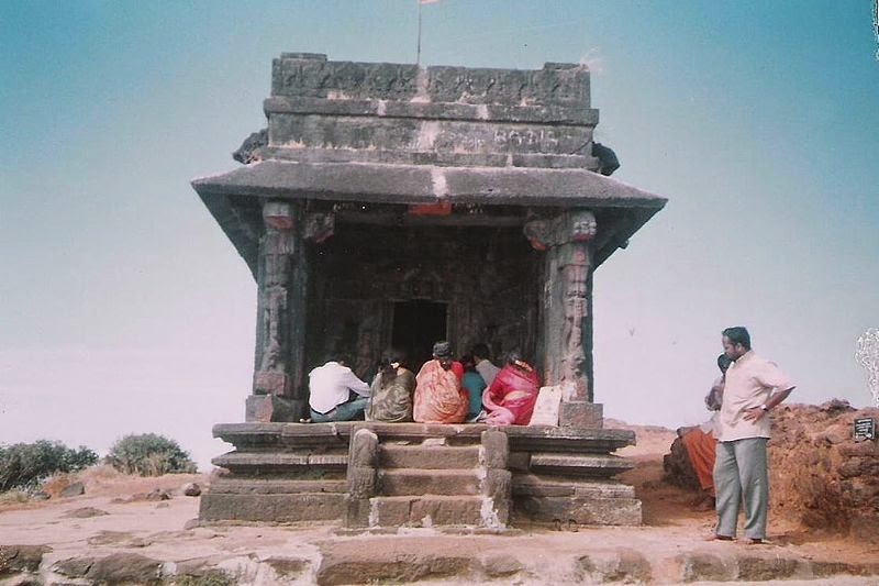
Bhimana Kindi near Kanchana Halli in Halgur (Malavalli) – Channapattana Road. This Hill has a Natural Rock Arch and is a good trekking place for beginners. Some believe that this arch was formed due to hitting of a huge rock by the Mace of the Bhima (Pandava, Mahabharatha). Geologists say that it is a natural phenomenon.

One has to go through the coconut farm and through the muddy road to reach the bottom of the hill. There is a Small temple at base of Bhimana Kindi which can be considered as Landmark point to start the trek. From this temple, one can find stair case type of steps which will take us to the top. one has to climb about more than 500 stone steps in order to reach the top of hill. The 35 light poles is a source of guidance to the top of the hill. It takes approximately 3hours to reach the top.

Animals like Bear, Elephant are found here, hence its advisable to travel in groups and avoid late nigh trekking or camping here.

Websites :

http://www.bgbaligatraveldiary.com/moon-light-night-trek-to-bhimana-kindi-with-bat/

Friday, February 10, 2017

Kalsubai Temple

Name : Kalsubai temple

Location :

The peak of Kalasubai is situated in Nagar district. This is apex, highest peak of the mountain range of Sahyadri. It is a dream of every sincere mountaineer to climb it at least once. Its height is almost 5,500 feet.

The Legend :


It is said, that in the ancient times, a lady named “Kalsu” came to nearby Indorey village to work. However, somebody forced her to clean utensils and clean up the residence by force. So she left the place and eventually died at this spot. So comes the name, Kalasubai. A small temple dedicated to Goddess Kalsubai is built at the peak and is worshipped by locals. A traditional pooja is performed at the summit temple every Tuesday and Thursday by local priest.


Festivals :

On occasion of Navratri, its a festive atmosphere as many people come to worship at the summit and Fair is organised during the nine days of Navratri.

About the Sanctuary :

The sanctuary area spreads from Kalasubai to Harischandragad in Akole Tehsil of Ahmednagar district. The area is part of Sahyadri hill ranges. The Kalsubai sanctuary is challenge to trekkers as it is most rugged, hilly area and difficult to get accessibility. Kalasubai is the highest (1646 m) peak of Western Ghats in Maharashtra. It is also a paradise for nature nad Flora lovers.

Trekking Experience :
 

The Trek is uphill climb and could take 3-4hrs climb and 2-3hrs descend from Base village Bari. After a climb of around 20minutes we came across temple of Kalsubai, which was the base temple at machi. Here we got the first glance of Diety Kalsubai.

At times we had to stop on the way as there would be long queue at certain points where it was important to climb slowly and also along with us there were other groups as well. The vegetation type is southern moist mixed deciduous. The part of Sahyadri that is close to West Coast is semi evergreen forest and semi deciduous shrub savanna. The main tree species that are seen in this area are Hirda, Jambhul, Chandawa, Bahava, Kumbhal, Gulchavi, Kudal, Siras, Kharvel, Karap, Avali, Aashind, Lokhandi, Beheda and character worth noticing.
After a climb of around 1hr one can reach first plateau, view from here of mountains covered with fogs and waterfalls was mesmerising. Trekkers can have some rest with group indulging in photo session at this point.
There are total of four ladders on the route and then there are carved steps on the rocks with railings on the side, this really make the route quite safe and easy.


Just before the last ladder, there is small hut or a shop where one could get hot kanda bhajia, tea and there was small well which was probably the only source of water in entire journey. From there we reach the fourth and final plateau.
Kalsubai Well On Top of Peak ! ! !
Best Time To Visit
August To December

Websites:
http://traveladventuresbyme.blogspot.in/2013/07/kalsubai-peak-mt-everest-of-sahyadris.html

Wednesday, June 4, 2014

Moola Mookambika Temple Kodachadri


Name :  Kodachadri Moola Mookambika Temple

Location :

Kodachadre Hill forms a background to the famed temple of Mookambika in Kollur. It’s placed at a distance of 21 kilometre from Kollur and 15 kilometre from Nagodi village in Hosanagara taluk. From Bangalore, one has to go to Shimoga (285 km) and from there, one can take public transport to reach Nagodi village (Hosanagara Taluk). From Udupi, it is three hours journey to Nagodi village, from where trekking starts.

Kodachadri peak is connected with an all rough jeep road (partially metalled) on which only jeeps can travel. As this hilly road is not maintained properly, only expert local jeep drivers can take the jeep to the top. Jeeps are available for hire at Kollur and at Kattinahole village near Kodachadri base. Motorcycle riding on this highly uneven, steep, mud track with sharp hairpin curves with gradients, may be challenging and risky.

Legend :

The temple is a popular destination for Hindu pilgrims and it’s said to place where thousands of years ago Goddess Mookambika fought and killed the demon Mookasura. In Historic times, individuals used to trek from Nagara state.

Description :

Sage Adi Shankara is claimed to have visited this place, meditated here. A small temple called Sarvajnapeetha, designed with stone is dedicated to Adi Shankara at the highest of Kodachadri. A temple dedicated to the traditional Mother god Mookambika is located near travelers cottage and is believed to be the moola sthana (the origin) of Sri Mookambika Devi. From this spot, it’s a 2 kilometer trek to the top. Just from there, a vertical path ends up in a little cave known as Chitramoola, from where the Mookambika temple of Kollur is visible.

A number of the pilgrims from South Indian states who visit Kollur take a trek to Kodachadri also. Dr. K. Shivarama Karantha, noted author of Udupi District trekked to Kodachadri in 1940s and appreciated the natural beauty of this place by placing Kodachadri as most lovely of 3 mountain peaks of coastal Karnataka (the alternative 2 being Kuduremukh and Kumara Parvata). Kodachadre is visited by locals and Keralites in large numbers since long term.


Sarvajna peetha:

Sarvajna Peeth is a little temple like structure near the height where Adi Shankara meditated. This little structure bears a name that is similar to Sarvajanapetha, additionally known as Sharada Peeth of Jammu and Kashmir (that was visited by Adi Shankara during his long religious journey, where he defeated different students in philosophical debate and opened the southern door of the temple).

Ganesha Guha is near the journey way to Sarvajna peetha.


Iron Pillar :

One iron pillar of concerning 5km 40 feet length is planted erect in front of Moola Mookambika Temple near peak of Kodachadre and its compared with large similar historic iron pillars placed at Dhar, Mount Abu etc. Devotees believe that this is the trishula utilized by god Mookambika to kill a demon known as Mookasura as per native tradition. Indian scientists from IGCAR Kalpakkam and KREC (Now NITK), Suratkal conducted a check on the Iron pillar and found that it had been made of traditional Indian metallurgic skills and not from fashionable casting ways. It’s found made from pure iron. It’s additionally found to be less affected by corrosion, despite of wet conditions prevailing there because of heavy rains. This iron pillar is considered as testimony of ancient Indian iron craftmanship.

Websites :

http://en.wikipedia.org/wiki/Kodachadri

http://www.beontheroad.com/2009/12/backpacking-through-western-ghats-day-7.html#

Friday, June 29, 2012

Narahari Parvatha Sadashiva Temple


Name : Narahari Parvatha Sadashiva Temple

Location :

Narahari Parvatha Sadashiva Temple is located at a distance of 28 km from Mangalore in Bantwal taluk of Dakshina Kannada district. Narahari Parvatha is surrounded by panoramic scenes and fascinating greeneries.

Legend :

According to a legend, Sri Krishna (Lord Hari) accompanied with Arjuna (Nara) offered penance here to free themselves from the sins committed during the Mahabharatha’s Kurukshetra war. Lord Hari as a sign of his visit sculpted Shanka (Conch), Chakra (Wheel), Gadha (Heavy Weapon) and Padma (Lotus) giving rise to the four ‘Teerthakoopas’ (Holy Ponds) which are present even today. Arjuna purified himself by bathing in these holy ponds and installed the Shivalinga and worshipped it and hence the hill gets its unique name ‘Narahari Sadashiva’.

Description :

This hill which is famous for its ‘Sadashiva Temple’ is 1,000 feet above sea-level holding mythological secrets dating back to the age of Pandavas.

It could be pilgrimage to the devotees or an expedition for the trekkers. It takes a climb of 333 steps to reach the top.

The boards that say ‘Shiva Shiva’ on the sides of the railing can be a motivation for the devotees to stick to their climb and hence honour their deity. Once you reach the top, the four ‘Teerthakoopas’ are an unbelievable sight as they are perfectly in the shape of a Shanka (conch), Chakra (wheel), Gadha (weapon) and Padma (lotus).


 Spectacular view :

The panoramic view from the top can keep anyone rooted to the ground for hours. When you stand on this mountain, you can see Sulliamale, Ballamale on the eastern side and Kadenjamale on the southern side. With national highway on one side and Mangalore Hassan railway line on the other, the sight of the graceful Nethravathi River makes the view exquisite. Soon after the magnificent sunset, the lights from the nearby towns such as Pane Mangaluru, Kalladka and B C road make us feel that we are gazing at the stars from heaven.


Festivals :

People throng this mountain during 'Aati Amavasya' and 'Sona Amavasya' for Teerthasnana (Dip in the ponds). The Renovated Bramhakalasha establishment day, Shivaratri, Nagapanchami and Sri Ganesh Chaturthi are the other festivals celebrated with pomp in this temple. The last Monday of the Karthika month is considered to be an auspicious and vibrant day as various religious and cultural programmes are held. Taking a dip in the ponds on this day is considered to be sacred. So, people are seen flocking the hill during this particular day.

Popular beliefs:

Devotees believe that by performing 'Baliwadu Seva' in this temple, people can overcome their fears. By performing 'Pasharpane' people can get relief from breathing problems, by performing 'Thotilu Magu Seva', the barren can be blessed with children and with Tender Coconut Abhisheka all the desires will be fulfilled.

Websites :

http://www.bantwal.com/narahari_parvatha.php

http://www.daijiworld.com/news/news_disp.asp?n_id=63015

Wednesday, June 13, 2012

Kamnadevi Temple


Name : Prospect Hill and Temple of Kamna Devi

Location :

Prospect hill has an elevation of about 2200 mts. above the sea level.The Prospect Hill temple takes about a fifteen minutes walk from Boileauganj that is located on the Shimla-Bilaspur road.

Description :

Prospect hill is crowned by a very religious temple dedicated to Goddess Kamna Devi.It is believed that the Goddess blesses anyone who takes the arduous journey up the hill.

A 15 minute climb on the steep Prospect Hill leads you to this small red and green temple, which is surrounded by a white wall. Calm and tranquil surroundings along with breath-taking views of the city, make your climb to this holy place perfectly worth it.

Surrounded by tall deodar trees, the temple has a glorious view of the surrounding hills and the toy trains running to and from Tara Devi. It is an ideal base for trekkers, nature lovers and bird watchers. The temple is open round the clock.

Thousands and lakhs of tourists visit this place because the beauty of this hill is eye-catching.You can have the look of surrounding areas and hills from the top of this hill.You will feel as if you are away from this world into a world that is so beautiful and so very rare with its basket of stupendous beauty. The scenic beauty of the place in the midst of green veiled mountains and passing clouds from the hill top is really something that will keep you mum.

This hill is paradise for photographers and mountaineers,as the hill satisfies their quest for trekking.Also the toy train that runs from Tara Devi to Jatogh is visible from the top of the Prospect Hill of Shimla. The place is even an ideal juncture for the picnic parties.

Websites :
http://indiatourist.wordpress.com/2008/11/02/prospect-hill-and-temple-of-kamna-devi/

Wednesday, May 2, 2012

Gergeti Trinity Church (Tsminda Sameba)


Name : Gergeti Trinity Church

Location :

Gergeti Trinity Church (Georgian: წმინდა სამება - Tsminda Sameba) is a popular name for Holy Trinity Church near the village of Gergeti in the Georgia. The church is situated on the right bank of the river Chkheri (the left tributary of the river Terek), at an elevation of 2170 meters, under Mount Kazbegi.


Description :

The Gergeti Trinity Church was built in the 14th century, and is the only cross-cupola church in Khevi province. The separate belltower dates from the same period as the church itself. Its isolated location on top of a steep mountain surrounded by the vastness of nature has made it a symbol for Georgia. The 18th century Georgian author Vakhushti Batonishvili wrote that in times of danger, precious relics from Mtskheta, including Saint Nino's Cross were brought here for safekeeping. During the Soviet era, all religious services were prohibited, but the church remained a popular tourist destination. The church is now an active establishment of the Georgian Orthodox and Apostolic Church

The church is a popular waypoint for trekkers in the area, and can be reached by a steep 3 hour climb up the mountain, or around 30 minutes by jeep up a rough mountain trail.

Website :

http://en.wikipedia.org/wiki/Gergeti_Trinity_Church

Sunday, March 6, 2011

Venguneswarar Temple at Vengundram


Name : Venguneswarar Temple at Vengundram

Location :

Just a km from Thennangur enroute to Vandavasi this Shiva temple at the top of a big and steep hill can be seen from the road itself.

Description :

It’s a tough hill to climb most part of it don’t have proper steps. It will really be a thrilling and adventures trip for anyone to go there. Make sure to go in a group or atleast minimum of 2 people and avoid children and aged people. Nobody and nothing is available at the top. It seems there is no priest for the temple but a person comes to do pooja once in a month. It is an open temple with a Shiva lingam, Murugan, Vinayagar and some other deities. You can do pooja yourself. The ideal time to visit is in the early morning.

Websites :

http://shanthiraju.wordpress.com/thiruvannamalai/

Sunday, April 12, 2009

Lingaparvata


Name : Lingaparvata

Location : Laos

Legend :
It is considered the Natural Linga of the World.

Long before King Divanika erected his stele in 456CE proclaiming Kuruksetra to be a holy place (tirtha) tribal people had gathered in the shadows of Lingaparvata looking in awe upon its lofty pinnacle reaching into the sky. But before Lingaparvata ever became known as Linga Mountain in praise of Lord Shiva this natural outcropping reaching 4645 feet into the sky was held in the minds of all indigenous people of the area as a great earth spirit where fire rituals and human sacrifices were a common practice.

Likewise in ancient India the greatest stories of mountains and gods were repeated orally for countless millennia until finally they were put in verse and the Book of Manu, Upanishads, Puranas, Rig Veda, Mahabharata, Ramayana and many more were all recorded for posterity. Today when we read these stories they seem like impossible accounts of how the gods of long ago traveled freely between earth's mountain tops and the heavens. And in a wholly desacralized cosmos where societies and nations have become predominantly secularized in their approach to existence, these ancient stories of gods and mountains are looked upon as fanciful myths without having any relationship to events taking place in the 21st century.

The gods of olden times have passed down to our civilizations of today their myths and legends by which to base our moral judgments and heroic deeds upon. If council and an audience with the gods were to be had it most likely would have taken place on a mountain top. These mountain abodes of the gods are well known and today they still hold special significance for cultures all around the world. In India and Tibet there are two mountains that are so revered for their acting as the home to Lord Shiva that sacred ceremonies are still conducted in their presence. One of the most sacred mountains in the world is Mt Kailash in Tibet and in southern India it is the sacred hill of Arunachela. Arunachela is regarded as a manifestation of Shiva himself and Mt Kailash is Shiva's actual abode.

In Laos, Lingaparvata became a focal point for austerities to Shiva in the fifth century under the vocable of Bhadresvara, the god of the Chams at My Hon-Son on the Champa (Vietnam) coast. The city of Kuruksetra and then later called Sreshthapura was the holiest ancient city for kings to make pilgrimage (tirtha yatra). In fact a 250 mile royal road runs from Angkor Wat directly to Vat Phu indicating there was a direct link to Vat Phu from the new Ankorean center.

From a distance Lingaparvata appears as a linga or even a small temple set on the summit where rituals to the gods would be performed. There is a Chinese document from the Sui dynasty (589-616CE) that mentions a temple on the summit of a mountain named Ling-kia-po-p'o, which is guarded by a thousand soldiers and consecrated to a spirit named Po-to-li. It was Georges Coedes, the famous French epigraphists, who transliterated Ling-po-p'o into Lingaparvata.

This was Shiva's pillar of fire that endlessly went into the heavens and endlessly passed down through the earth. Here was the penultimate axis of the world and once the Brahmins from India saw this outcropping they could do none other than name this mountain Lingaparvata. This one linga would be impossible to move, and would provide the devotee with a substantive feeling of awe simply by recognizing the latent power of this mountain made it possible to communicate with the gods. It was on this mountain that the priests had developed the Cakravartin cosmology that in 400 years would establish the consecration of the Khmer Empire where Shiva, Vishnu, and Brahma would be the gods that would establish divine kingship for another 500 years.

If Mt Kailash in Tibet is considered the home of Shiva and Arunachela is considered an actual manifestation of Shiva then I would offer that Lingaparvata could be thought of as the temple of Shiva whereby divine communication with all the gods would take place. My justification for making such a statement and associating Lingaparvata with a temple gateway to meet the gods is by recognizing that the Khmer Empire got its spiritual guidance from the environs of Kuruksetra. The combination of Vat Phu, Lingaparvata, the sacred spring and King Jayavarman IIs inscription at Vat Oubmong indicate an auspicious focal point that merits calling Lingaparvata a temple gate way to the gods. It was in 802CE that King Jayavarman II consecrated the Khmer Empire and he became the "Cakravatin" and established the union between god and king and the beginning of the "Devaraja" cult worship.

Such auspicious and sanctified acts I believe originated at Lingaparvata (Shiva's holy temple to speak to the gods). Coincidentally on the same night of Shivaratri when Shiva married Parvati is also the same night Shiva swallowed the poison brought forth from the churning of the milky ocean and thus saved the world. Shiva stabilized the earth on this night as a result of his communicating with the gods who asked him to save the world. Consequently we can also think of the holy mountain of Lingaparvata as the symbolic representation of Shiva saving the world from oblivion. The world axis (Skamba) held the universe in place and Lingaparvata acted like Mt Mandara; the mythical mountain used to churn the heavens and save the earth so it would not fall into the nether world.

More information about Trekking adventures to LingaParvata is found on the website below :
http://www.earthportals.com/Portal_Messenger/lingaparvata.html


Sunday, March 22, 2009

Parvatha Malai


Name : Parvathamalai
Location : Near to Thenmathimangalam village, which is 20 kms from Polur in Thiruvannamalai District, Tamilnadu. Polur is 35kms(approx)from Thiruvannamalai(Arunachala).
Altitude : The hill(Parvatamalai) is 3500 feet(Approx) high from the sea level.
Diety : On the top of the hill, Lord Mallikarjunaswamy(Sivan) temple is located, which is believed to be 2000 years old. It is believed that devas and siddhas are worshipping Lord Mallikarjunaswamy every night here. This place is very auspicious and has powerfull vibrations from the religious point of view.This hill is full of herbal(mooligai) plants.
Annadhanam will be provided in this ashram for devotees.During the Pournami full moon day, this hill attracts a lot of devotees and believed that many strange things use to occur, which cannot be defined by the language of Science.

Reaching the hill is the most difficult. Going alone or without knowing the route is very dangerous as you might loose your track. So it is always advisable to go in a group on which one should know the route.

Trekking attraction : The "Kadapaarai padhai". Considered to be the toughest part of the trek, the climb was very steep and this stretch is bit difficult it is punctuated by iron rods drilled into the rocks and chains to assist at a sharp ascent of about 3500 feet and it is an one way traffic, one person can only climb at a time, you have to be sure on the other side no one comes, you have to raise your voice from the bottom and once acknowledgment comes from the other end then only you can climb or you will be get caught in the middle. It is safe to remove all the shoes and climb in bare foot.
No of Hills : Seven
Stala Puranam : http://parvathamalai.com/Stalapurana.html
Website : http://parvathamalai.com/
Pictures : http://picasaweb.google.com/syaarumugam/Parvathamalai#


Friday, March 20, 2009

Veliangiri Hill temple


Name : Velliangiri, Rajathagiri, Velliangiri, Dakshin Kailash or Bhoolok Kailash
Location : 40 kms from Coimbatore, in the western ghats.
Altitude: 6000 ft.

Stala Puranam : According to legend, is where Siva performed his cosmic dance on the request of Umadevi. The five faces of Lord Shiva, Brahma, Vishnu, Rudra, Maheshwara and Sadasiva, are seen as Panchagiri and as Panchalingas pertaining to the panchabhutas, in Velliangiri. The hill ranges have abundant natural resources, which include rare herbs.
Dieties : Lord Panchalingesa and his Consort Manonmani Amman alias Parvathi, bestow their grace on the devotees who throng here annually between February and May.

No of Hills : 7

Trekking Adventure :
The Thiruneer (sacred powder) Malai which is the sixth Hill is slippery and adventurous. This hill is descending when we climb and ascending when we return.
Also there are attractions like Seethai vanam, Beeman Urundai,
Stala Theertham : Kaithatti Sunai, Paampatti sunai, Aandi Sunai

Tips : Before climbing you have to get the bamboo sticks. This is not much needed when we climb. It is very necessary when we ascend down the hill. The stick gets the vibration and power so that pilgrims bring it to home and keep in Pujai room.

LinkWithin

Related Posts Plugin for WordPress, Blogger...