Sunday, July 10, 2016

Jnana Malai Murugan Temple, Kaverippakkam

Name : Jnana Malai Murugan Temple

Location :

Until recently the celebrated Jñāna Malai (Mount of Wisdom) could not be identified. Lord Jñāna Murugan only recently disclosed His presence at Jñānamalai situated near Kaverippakkam in Vellore district at a small village called Govindacheri 14 kilometres from Kaverippakkam. Though it a small hillock, yet there is no easy way to reach the top of the hill.

Description :

Lord Muruga is the embodiment of jñāna (spiritual insight). He is Jñāna Panditan, Jñānaswaroopan, etc. By worshipping the Lord as Jñāna Panditan, one obtains jñāna.

There is a small Murugan temple on this hill. In 1998 some local people along with Archeological Department officials discovered a worn stone inscription which translated affirms:

"...in the 18th year of King Sambuvarayar's rule, his son Prince Kaligarayan established steps to reach Jnānamalai of this village..."
The period is established as AD 1322-1340. On seeing this news item in the newspaper Dinamani our tiruppugazh thondar Ra. Krishnan, the author of several books including Arunagirinathar Adicchuvattil (In the Footsteps of Arunagirinathar), visited the site, conducted research and established conclusively that this sthalam is indeed Jñāna Malai celebrated in the songs of Saint Arunagirinathar.

Hectic activity followed, and last year some abishekams were performed by our Siruvapuri Murugan Abishega Committee and on 15 September 2000 kumbhabhishekam was performed after moderate renovation by the villagers.

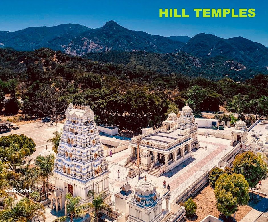
There is a small temple in typical Pallava style on the hill with a small sanctum and a mandapam. The Lord is in the form Brahmasastā having rosary and kamandala in two hands. The other two hands are in abhaya mudra and resting upon the hip. Generally in Thondai Mandalam (north Tamil Nadu) Pallava and early Chola images conform to this Brahmasastā form. About three feet high with Valli and Devasena as consorts, these are beautiful moolasthana vigrahas. He is called Bālasubramanyar by local people.

Near the temple there is a small natural water source from which water is brought for temple abulations. On to the west there is a small Siva temple and behind we can see footsteps in the rock. They appear as footprints on molten lava. Incidentally this is a volcanic mountain from all appearances.

Foot steps of Lord Muruga
These footsteps are considered by the local folks as those of Lord Muruga Himself. There is also a belief that Murugan visited this place after marrying Valli Amman in Vallimalai on way to Tiruttani. Tiruttani and Vallimalai form form a triangle with Jñāna Malai and both can be seen from this hill. Around the hill there is a lake and in rainy season will look like an island.

Arunagirinathar came to Jnanamalai and recalled "his experience of being hated by his wife, own family members and local folks, decides to end his life and at that time Murugan shows His lotus feet and bless him. He wants the same blessing again." This internal evidence of the saint's life is found only in the Tiruppugazh of Jñāna Malai.

This tiruppugazh starts with "Maniaval nagaikka ooril anaivarum nagaikka loka..." There is also another Tiruppugazh for Jnanamalai starting "Soodukolai..."

Help make Jñāna Malai accessible to Murugan devotees

In order to facilitate worship this important Murugan temple we need to provide steps and other basic amenities.

Siruvapuri Murugan Abishega Committee members have decided to construct the steps as well as other facilities. As a first step on 19 August 2001 in the presence of Mr. T.R. Srinivasan (I.A.S.), Special Commissioner for Hindu Religious Charitable Endowments of the Government of Tamil Nadu, a foundation stone was laid and the formal inauguration of this great task was undertaken with the blessings of Lord Jnanamalai Murugan. For about five hours Thiruppugazh Anbargal sang tiruppukazh followed by abhishekam and annadanam. Hundreds of people attended this great event.

Murugan adiyars who wish to contrbute to this great cause are strongly encouraged to make material contributions. The hill needs about 225-250 stone steps to reach the summit. Each stone step costs about Rs. 2,000 (or US$ 42) to construct. In addition we intend to construct a small mandapam for the devotees in front of the sannidi and also other basic facilities (cooked food for annadanam is brought from Chennai currently). There will also be two small stone mandapams for pilgrims to rest on the way up and one at the foot of the hill as well.

Murugan adiyars and Kodaivallals are welcome to contribute liberally to the noble cause of steps. With each step, you will be drawn one step closer to Jñāna Malai Jñāna Panditan.

Websites:

Ratnagiri Murugan Temple


Name : Rathinagiri Bala Murugan Temple

Location :

The Ratnagiri Balamurugan Temple is situated at Vellore in TamilNadu.This temple is around 13 kms away from Vellore adjacent to the vellore chennai national highway. Ratnagiri Bala Murugan temple is a small and cute temple. Lot of devotees visit Vellore Golden Temple, or travel to Vellore can visit this great shrine of Lord Murugan and get his blessings.

Greatness of the Shrine:

Rathinagiri Bala Murugan Temple was built around the 14th century. Over the passage of time an ordinary sand structure was converted into a stone shrine. Ancient Hindu scriptures say that wherever there is a hill, Lord Murugan resides as the all-powerful Deity. Of these Tirupparamkundram, Tiruchendur, Tiruvavinankudi, Tiruveragam and Palamuthircholai are famous shrines, collectively called 'Kundruthoradal'. The holy shrine at Rathinagiri also features in this category.

Literary Evidence:

The 14th Century poet Arunagirinathar has sung about this temple as Rathinakiri Vazh Murukane Ilaya Vaaramarar Perumaley', which means 'Murugan, the God of Devas resides in Rathinagiri'.

Divine Blessings

The Omnipotent Power manifests His Blessings to mankind in three forms:

In the form of idol in the shrine.
In the form of the guru.
In the form of the devotee.
Of these three, Lord Bālamurugan manifests himself at Rathinagiri in two forms. The first is in the form of the deity with his two consorts Valli and Teyvanai. The second is in the form of our Guru, Swami Bālamurugan Adimai.

The History of Swami Balamurugan Adimai through whom the Blessings of Lord Bālamurugan are channeled to us is praise worthy.

History of Swami Balamurugan Adimai

Born on the 24th of January 1941 (in the Vikrama year of the Tamil calendar on the 11th day of the month of Thai) in the small village of Kilminnal adjacent to Rathinagiri, he was the fourth child born to Śrī Kandaswami Mudaliar and Smt. Sinagarammal. He was named Dakshinamurthy and Sachidanandam, both being names of Lord Shiva.

On completion of his schooling he entered the services of the Electricity Department. Soon after, he entered into holy matrimony with Sivakami and was blessed with two daughters and a son.

One day in his 27th year, on his way to work, he climbed the hill to offer his prayers. There was neither camphor nor incense available at the temple. He walked around the shrine with a heavy heart and was suddenly overcome with divine awakening. He fell in a faint to the ground and on waking up was unable to remember his own self. He dressed himself in a loincloth. He took a sacred vow not to leave until the temple was restored to its former glory.

This memorable event of Swami's spiritual awakening took place on 20th March 1968. Ever since then Swami's spiritual well being of his devotees has continued unabated.

Cottages for visitors

Cottages for the devotees have been built and are available. Separate pathways were laid to ascend and descend the hill.

Temple hours

Temple is kept open between 6 am to 1 pm & 4 pm. to 8 pm.
Abhishekam timings: 6 am to 10:30 am & 5:30 pm.
Temple office working hours: 9 am to 1 pm & 3 pm to 6 pm.
Days of principal importance in the calendar year

Tamil New Year Day;
Ādi Krittikai celebrations (Lord Murugan's Birthday);
Ādi Velli (auspicious Friday in the month of August or September);
Kanda Shashti celebrations (Six Days);
Navaratri (Nine Nights of the Goddess Festival);
Panguni Uttiram;
January 1st;
The anniversary of Swamiji's enlightenment 20th March

Website :

http://murugan.org/temples/ratnagir.htm

Saturday, July 2, 2016

Yaganti Uma Maheswara Swamy Temple & Agastiya and Venkateswara swamy Cave Temples

Name : Yaganti Uma Maheswara Temple

Location :
Yaganti is located in the Kurnool District in the state of Andhra Pradesh, India, approximately 100 km from the city of Kurnool and 75 kms from Tadipatri in the state of Andhra Pradesh. The temple is 14 km west of Banaganapalle (Mandal headquarters) on the Banaganapalle-Peapully road. This place is nestled in the middle of some hostile terrain like the the dry, rocky region of Erramala Hills.

Legend :
One story of the site's origin is as follows: The sage Agastya wanted to build a temple for Lord Venkateswara on this site. However, the statue that was made could not be installed as the toe nail of the idol got broken. The sage was upset over this and performed a penance for Lord Shiva. When Lord Shiva appeared, he said the place suits Shiva better as it resembles Kailash. Agastya then requested Lord Shiva to give the devotees a Parvathi Goddess as Lord Uma Maheswara in a single stone, which Lord Shiva obliged.

A second story is as follows: Chitteppa, a devotee of Lord Shiva, was worshiping Lord Shiva and Lord Shiva appeared to him as a tiger. Chitteppa understood that it was Lord Shiva in tiger form, and shouted Neganti Shivanu ne kanti (meaning: I saw Shiva I saw), and danced with joy. There is a cave called Chitteppa nearby.

Popular Beliefs :

Growing Nandi :
The devotees believe that the Nandi idol in front of the temple is continuously increasing its size. The locals say that the idol was initially much smaller than its present size. They say that certain experimentation was carried out on this idol and it was said that the type of rock out of which the idol is carved has a growing or enlarging nature associated with it. Archaeological Survey of India has confirmed that the idol increases by 1 inch in every 20 years. Experiment suggests that the rock used to make the idol exhibits a growing nature.

It is said that people used to do Pradakshinas (rounds) around it in the past. The temple staff has already removed one pillar as the size of the Nandi has increased.

According to Potuluri Veera Brahmendra swamy, the Basavanna (stone nandi) of Yaganti will come alive and shout when Kali Yuga ends.
Absence of crows

Legend has it that while the Sage Agastya was performing his penance, crows disturbed him and he cursed that the crows cannot enter the place. As the crow is the Vahana for Lord Shani, it is believed that Lord Shani cannot enter this place.

Description :

This temple was constructed by King Harihara Bukka Raya of the Sangama Dynasty of the Vijayanagara Empire in the 15th century. It was built according to Vaishnavaite traditions.

Sri Yaganti Uma Maheswara Temple is one of the few temples patronized by one of the great dynasties of India. Every year Maha Shivaratri is celebrated and a large number of devotees from all over Andhra Pradesh visit. Shiva, Parvati and Nandi are the main deities in this temple.This temple is 14 km away from Banaganipalli in kurnool dt. The saint lord Veerabrahmendra swami stayed here for some time and wrote Kalagnanam.

A feature of this temple is its Pushkarini, a small pond of water on the temple premises. Water flows into this Pushkarini from the bottom of hill through the mouth of a Nandi (bull). The water is fresh and sweet, as it comes from the hills. No one knows how the water reaches the pond all year round and this temple architecture in terms of its sculpture shows the skills of ancient Vishwakarma Sthapathis. Devotees find that a holy bath in Pushkarini is highly beneficial. After taking a bath in Pushkarini, they pay tributes to Lord Shiva.

The sage Agasthya bathed in Pushkarini and worshipped Lord Shiva.

Yaganti Caves :
Agastya Cave :
This is the cave where Agastya performed his penance for Lord Shiva. One can enter the cave by climbing 120 steep steps. An idol to Devi is installed and may be worshipped here.

Venkateswara Cave :
The damaged idol of Lord Venkateswara is present in this cave. Compared to Agastya cave it is easy to climb though the steps are steep. According to the story this idol was present in this cave before the Tirumala Venkateswara Temple was constructed. But as the idol is damaged near the foot, it could not be worshipped. Sri Sri Potuluri Veera Brahmendra Swami tells us in his Kala Gynanam that this place can stand as an alternative to Tirupati. This temple has very beautiful scenic locations nearby.

Veera Brahmam Cave :
This is the cave where saint Sree Potuluri Veera Brahmendra swamy wrote some of his Kala Gnaanam (prophecy). The height of the cave is less and one needs to bend half over to enter it.

Websites :

https://en.wikipedia.org/wiki/Yaganti

Friday, June 17, 2016

Panch Kedar Yatra (pilgrimage)

Panch Kedar (Sanskrit: पंचकेदार) refers to five Hindu temples or holy places of the Shaivite sect dedicated to god Shiva. They are located in the Garhwal Himalayan region in Uttarakhand, India. They are the subject of many legends that directly link their creation to Pandavas, the heroes of the Hindu epic Mahabharata.

The five temples designated in the strict pecking order to be followed for pilgrimage for worship are the Kedarnath (Sanskrit: केदारनाथ) at an altitude of 3,583 m (11,755 ft), the Tungnath (तुंगनाथ)(3,680 m or 12,070 ft), Rudranath (रुद्रनाथ) (2,286 m or 7,500 ft), Madhyamaheshwar (मध्यमहेश्वर) or Madmaheshwar (3,490 m or 11,450 ft) and Kalpeshwar (कल्पेश्वर) (2,200 m or 7,200 ft). The Kedarnath is the main temple, which is part of the four famous Chota Char Dhams (literally 'the small four abodes/seats') or pilgrimage centers of the Garhwal Himalayas; the other three dhams are the Badrinath, Yamunotri and Gangotri. Kedarnath is also one of the twelve Jyotirlingas


History

It is said that the Panch Kedar Yatra (pilgrimage) could be directly related to the Gorakhnath cult (recognized for their pilgrim traditions) of Nepal. As a proof, it is stated that the culmination of the pilgrimage was at Pashupatinath temple in Nepal, rightly where Lord Shiva’s head is worshipped and not at Kedarnath where the hump is venerated. A further supporting fact mentioned in this regard is that the emblem used in Kedarnath temple dome is the same as displayed in the Pashupathinath temple dome in Kathmandu.

Legends

Many folk legends related to the Garhwal region, god Shiva and the creation of the Panch Kedar temples are narrated.

The most famous folk legend about Panch Kedar relates to the Pandavas, the heroes of the Hindu epic Mahabharata. The Pandavas defeated and killed their cousins — the Kauravas in the epic Kurukshetra war. They wished to atone for the sins of committing fratricide (gotra hatya) and Brāhmanahatya (killing of Brahmins — the priest class) during the war. Thus, they handed over the reigns of their kingdom to their kin and left in search of the god Shiva and to seek his blessings. First, they went to the holy city of Varanasi (Kashi), believed to Shiva's favourite city and famous for its Shiva temple. But, Shiva wanted to avoid them as he was deeply incensed by the death and dishonesty at the Kurukshetra war and was, therefore, insensitive to Pandavas' prayers. Therefore, he assumed the form of a bull (Nandi) and hid in the Garhwal region.

Not finding Shiva in Varanasi, the Pandavas went to Garhwal Himalayas. Bhima, the second of the five Pandava brothers, then standing astride two mountains started to look for Shiva. He saw a bull grazing near Guptakashi (“hidden Kashi” — the name derived from the hiding act of Shiva). Bhima immediately recognized the bull to be Shiva. Bhima caught hold of the bull by its tail and hind legs. But the bull-formed Shiva disappeared into the ground to later reappear in parts, with the hump raising in Kedarnath, the arms appearing in Tunganath, the nabhi (navel) and stomach surfacing in Madhyamaheshwar, the face showing up at Rudranath and the hair and the head appearing in Kalpeshwar. The Pandavas pleased with this reappearance in five different forms, built temples at the five places for venerating and worshipping Shiva. The Pandavas were thus freed from their sins. It is also believed that the fore portions of Shiva appeared at Pashupatinath, Kathmandu — the capital of Nepal.

A variant of the tale credits Bhima of not only catching the bull, but also stopping it from disappearing. Consequently, the bull was torn asunder into five parts and appeared at five locations in the Kedar Khand of Garhwal region of the Himalayas. After building the Panch Kedar temples, the Pandavas mediated at Kedarnath for salvation, performed yagna (fire sacrifice) and then through the heavenly path called the Mahapanth (also called Swargarohini), attained heaven or salvation.[citation needed]

After completing the pilgrimage of Lord Shiva's darshan at the Panch Kedar temples, it is an unwritten religious rite to visit Lord Vishnu at the Badrinath Temple, as a final affirmatory proof by the devotee that he has sought blessings of Lord Shiva

Worship rights

The priests and pundits who worship in the Panch Kedar temples are from South India, except in Tungnath. Namboodiri brahmins hailing from Malabar, in Kerala officiate as chief priests at Badrinath temple and they are known by the name Rawals. Jangamas who are pure Lingayatisms from Chitrakal in Mysore are the chief priests at the Madhyamaheswar temple. Dasnami Gosains founded by Adi Shankaracharya are the chief priests in Rudranath and Kalpeshwar temples. The Tunganath temple is served by the Khasi Brahmins. In the case of Tungnath, it is also said that the local brahmins from Mokumath officiate as priests.

Kedarnath Teerth Purohit all Kedarnath Teerth Purohit (Panda) are the ancient brahmin of this himalaya region of Kedarkhand, these are there from the end of treta yug and start of kaliyug, when pandava came to himalaya for finding moksh, and then went to mahapanth, after their journey to mahapanth, their grandson King Janmejay came to Kedarnth and gave the right of worshiping of Kedarnath temple to these brahmins

THE TREK :

The total trek length to cover all the five temples of Panch Kedar is about 170 km (including road travel up to Gaurikund), involving 16 days of strenuous and rewarding effort. The trek starts from Gauri Kund, one of the picturesque spots, providing spectacular views of the Himalayan range of hills in the entire Garhwal region, comparable to the Alps. The trekking is undertaken during two seasons; three months during summer and two months after the monsoon season, as during the rest of the period, except Rudranath, the other four Panch Kedar temples are inaccessible due to snow cover.

The road from Rishikesh is the first entry point to Garhwal from the plains of Uttarakhand. Rishikesh is approachable from Delhi by road over a distance of 230 km. The road from Rishikesh leads to the Gaurikhund on the Rudraprayag–Kedarnath road from where the trekking would start to Kedarnath temple. The trek to Kedarnath is of 14 km, each way. After Kedarnath, road travel to Guptakashi and further to Jagasu covers a distance of 30 km. From Jagasu, the trek to Madhaymaheshwar temple via Gaundhar is over a distance of24 km (15 mi). This trek provides spectacular views of the Chaukhamba, the Kedarnath and the Neelkanth peaks. Returning from Madhyamaheshwar the road drive to Chopta via Jagasu is of 45 km. From Chopta, the trek is to the Tunganath temple over a distance of about 4 km. After the Tunganath trek, the drive along the road up to Mandal (known Cherrapunji of Garhwal due to heavy rainfall) is for a distance of8 km. From Mandal, the trek to Rudranath temple is of 20 km. After visiting Rudranath temple the return journey is to Mandal and the drive down by road to Helang. From Helang, the trek to Kalpeshwar temple is for 11 km via Urgam village and is considered strenuous due to the steepness of the route. After completing the pilgrimage trek of Kalpeswar temple, the last of the Panch Kedar temples, the return road drive from Helong to Riishikesh via Pipalkothi is a distance of 233 km.

Worship during winter season

During the winter period when the temples are inaccessible due to snowfall, the sanctified symbolic Shiva idol of Kedarnath is worshipped at the Omkareshwar temple at Ukhimath, the representational idol of Tunganath is worshipped at Mokumath, the Rudranath symbolic image is brought to Gopeshwar, and the Madhyamaheshwar symbolic idol is venerated at Ukhimath

Websites :

https://en.wikipedia.org/wiki/Panch_Kedar

1. Kalpeshwar
2. Rudranath
3. Madhyamaheshwar
4. Tungnath
5. Kedarnath 

Friday, April 29, 2016

Tibidabo Spain


Name : Tibidabo - Mountain where Jesus was first tempted by the Devil

Location :

A mountain overlooking Barcelona, Catalonia, Spain, Tibidabo stands more than 500 meters tall. The highest peak anywhere in the Serra de Collserola range, Tibidabo is home to an amusement park, a telecommunications tower, and Sagrat Cor, a Catholic church.

Legend :

Sagrat Cor is perhaps the most fitting of Tibidabo's attractions as this is the site where local legend says the devil tempted Jesus. The name Tibidabo derives from the Latin Vulgate Bible verses, Matthew 4:9 and Luke 4:6. The phrase, tibi dabo, means I will give to you. It was supposedly said to Jesus by the devil as they looked down from a mountain on the kingdoms of the world. The name of Barcelona's hill, then, refers to how it is the tallest anywhere around.

Description:

Designed by Enric Sagnier, the church took about 60 years to build. At the top of the church, Sagrat Cor, is a sculpture of the Sacred Heart by Josep Miret Llopart.

Tibidabo can be reached by a funicular railway, by bus, and by car. The railway, built in 1901, was the first of its kind in Spain. The amusement park is also the oldest of its kind in the area. Constructed in 1899, the park offers more than thirty different rides, some of them dating back many decades. A few of the original attractions are also still operating, including the Museu d'Autòmates (Mechanical Museum).
 

Websites :
http://www.atlasobscura.com/places/tibidabo

El Peñón de Guatapé


Name : El Penon de Guatape

Location :

La Piedra Del Peñol (Spanish for "The Rock of Guatapé"), also known as El Peñol Stone or simply La Piedra (Spanish for "The Stone"), is a monolithic formation located at the town and municipality of Guatapé, 1 km inside the city limits (86 km northeast of Medellín or 2 hours by bus) in Antioquia, Colombia.

History :

The wide Antioquian rock base, called "batlolito antioqueño", and the "Peñón" were formed millions of years ago.

The Tahamies Indians, former inhabitants of this region, worshiped the rock and called it in their language "mojarrá" or "mujará" (rock or stone).

Description :

This rock is located in the rural area called "La Piedra", just 5 minutes from the town of Guatapé, and can be reached by road.

On the northern face of the stone there are painted large white letters, "G", and an incomplete "U" (only the single vertical stroke was completed). Guatapé and El Peñol had long disputed ownership of the rock, and the residents of Guatapé decided to settle the matter by painting the town's name on the rock in huge white letters. It did not take long for the residents of El Peñol to notice the work, and a large mob was assembled to stop it. Only the "G" and part of the "U" were completed.


The rock was first climbed officially on July 1954. In 2006, Luis Villegas, Pedro Nel Ramírez and Ramón Díaz climbed the rock in a five-day endeavor, using sticks that were fixed against the rock's wall. (It is unknown whether the Tahamies had a way of ascending the stone.). Climbing the huge stone took five days, but the top of the rock revealed beautiful views and a new species of plant, Pitcairma heterophila. The rock soon became a modest tourist attraction.

A new species of plant was found on the top of the rock, subsequently named Pitcairma heterophila by a German scientist.

A viewing spot was built on top of the rock, where it is possible to acquire handicrafts, postcards, and other local goods. It is possible to see the 500 km shore-perimeter dam. There are 740 steps to the uppermost step atop the building at the summit, a fact reinforced by yellow numbers also seen in the climb up the stairs.

In the 1940s, the Colombian government declared it a "National Monument"

Composition :

The Stone of Peñol is composed of quartz, feldspar and mica. The rock, which is almost entirely smooth, has one long crack, the one that the climbers used in ascending it. In the crack was later wedged a 649-step masonry staircase, that appears like a giant stitch holding the split rock together, the only way to get to the top of the Piedra de Penol. In the 1970s, the area was dammed, and the view from the rock changed: It now overlooks a dramatic series of lakes and islands.

Today, you can ascend the rock (apparently owned by a local family, though also designated by Colombia as a "national monument") for 2 US dollars. There you'll find a few religious relics and a three-story lookout tower.

Websites :

http://www.atlasobscura.com/places/el-penon-de-guatape

https://en.wikipedia.org/wiki/El_Peñón_de_Guatapé

LinkWithin

Related Posts Plugin for WordPress, Blogger...